Area Overview for HX3 7UT
Photos of HX3 7UT
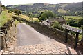
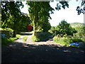
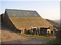
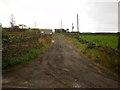
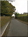
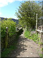
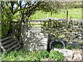
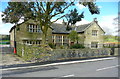
60 photos from this area
Area Information
Key information about the HX3 7UT including its size, population, and administrative classification.
- Area Type
- Postcode
- Area Size
- 12.7 hectares
- Population
- 2017
- Population Density
- 625 people/km²
House Prices in HX3 7UT
26
Properties
£226,584
Average Sold Price
£80,000
Lowest Price
£395,000
Highest Price
Showing 26 properties
| Address | Type | Beds | Baths | Last Sale Price | Last Sale Date | |
|---|---|---|---|---|---|---|
| 56 Brow Lane, Shibden, Halifax, HX3 7UT | Cottage | 2 | 1 | £267,500 | Dec 2024 | |
| 6 Brow Lane, Shibden, Halifax, HX3 7UT | house | - | - | £208,335 | Aug 2016 | |
| 60 Brow Lane, Shibden, Halifax, HX3 7UT | Detached | - | - | £295,000 | Nov 2012 | |
| 48 Brow Lane, Shibden, Halifax, HX3 7UT | house | - | - | £230,000 | Jun 2012 | |
| 50 Brow Lane, Shibden, Halifax, HX3 7UT | house | - | - | £135,000 | Jun 2011 | |
| 52 Brow Lane, Shibden, Halifax, HX3 7UT | house | - | - | £121,000 | May 2010 | |
| 24 Brow Lane, Shibden, Halifax, HX3 7UT | Terraced | - | - | £162,000 | Oct 2007 | |
| 66 Brow Lane, Shibden, Halifax, HX3 7UT | Detached | 5 | 2 | £395,000 | Sep 2006 | |
| 42 Brow Lane, Shibden, Halifax, HX3 7UT | Detached | - | - | £372,000 | Sep 2006 | |
| 26 Brow Lane, Shibden, Halifax, HX3 7UT | house | 2 | 1 | £80,000 | Jan 2001 |
Page 1 of 3
Energy Efficiency in HX3 7UT
Amenities
Schools
| Rank | School | Type | Entry gender | Ages |
|---|
Explore more schools in this area
Go to Schools tabDemographics
Household Size
Family (3-5 people)
most common
Accommodation Type
Houses
most common
Tenure
78
majority
Ethnic Group
White
most common
Religion
N/A
most common
Household Composition
N/A
most common
Age
47
median
Adults (30-64 years)
most common
Household Deprivation
N/A
with no deprivation
NS-SEC
45
in Lower managerial occupations
Explore more demographic insights in this area
Go to Demographics tabPlanning
Planning Constraints
- Flood RiskPremium
- Ramsar Wetland SitesPremium
- Area of Outstanding Natural BeautyPremium
- Protected Nature ReservePremium
- Protected WoodlandPremium