Area Overview for HX3 7ET
Photos of HX3 7ET
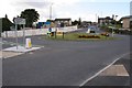
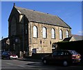
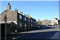
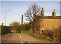
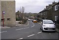
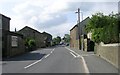
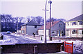
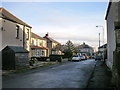
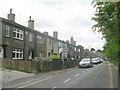
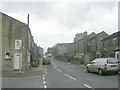
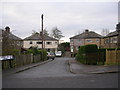

100 photos from this area
Area Information
Key information about the HX3 7ET including its size, population, and administrative classification.
- Area Type
- Postcode
- Area Size
- 6.9 hectares
- Population
- 2017
- Population Density
- 625 people/km²
House Prices in HX3 7ET
71
Properties
£209,391
Average Sold Price
£58,950
Lowest Price
£395,000
Highest Price
Showing 71 properties
| Address | Type | Beds | Baths | Last Sale Price | Last Sale Date | |
|---|---|---|---|---|---|---|
| 27 Upper Hall View, Northowram, Halifax, HX3 7ET | house | 2 | - | £212,500 | Aug 2025 | |
| 36 Upper Hall View, Northowram, Halifax, HX3 7ET | Detached | 4 | 2 | £355,000 | Jan 2025 | |
| 28 Upper Hall View, Northowram, Halifax, HX3 7ET | Detached | 4 | 2 | £375,000 | Aug 2023 | |
| 38 Upper Hall View, Northowram, Halifax, HX3 7ET | Retail | 3 | 1 | £310,000 | May 2022 | |
| 61 Upper Hall View, Northowram, Halifax, HX3 7ET | house | - | - | £310,000 | Dec 2021 | |
| 20 Upper Hall View, Northowram, Halifax, HX3 7ET | house | - | - | £342,500 | Sep 2021 | |
| 32 Upper Hall View, Northowram, Halifax, HX3 7ET | house | 5 | 2 | £385,000 | Oct 2020 | |
| 75 Upper Hall View, Northowram, Halifax, HX3 7ET | house | - | - | £270,000 | Sep 2020 | |
| 6 Upper Hall View, Northowram, Halifax, HX3 7ET | house | - | - | £375,000 | Sep 2020 | |
| 69 Upper Hall View, Northowram, Halifax, HX3 7ET | Detached | 3 | 2 | £267,500 | Mar 2020 |
Page 1 of 8
Energy Efficiency in HX3 7ET
Amenities
Schools
| Rank | School | Type | Entry gender | Ages |
|---|
Explore more schools in this area
Go to Schools tabDemographics
Household Size
Family (3-5 people)
most common
Accommodation Type
Houses
most common
Tenure
78
majority
Ethnic Group
White
most common
Religion
N/A
most common
Household Composition
N/A
most common
Age
47
median
Adults (30-64 years)
most common
Household Deprivation
N/A
with no deprivation
NS-SEC
45
in Lower managerial occupations
Explore more demographic insights in this area
Go to Demographics tabPlanning
Planning Constraints
- Flood RiskPremium
- Ramsar Wetland SitesPremium
- Area of Outstanding Natural BeautyPremium
- Protected Nature ReservePremium
- Protected WoodlandPremium