Area Overview for HX2 9WX
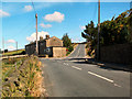
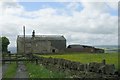
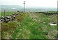
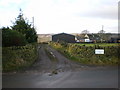
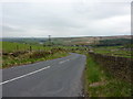
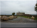
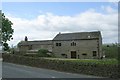
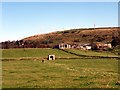
Photos of HX2 9WX


Area Information
Living in HX2 9WX means being part of a tightly knit residential cluster in England, home to 1,741 people spread across a compact area with a population density of 244 people per square kilometre. This postcode area is characterised by a quiet, stable community, with most residents aged between 30 and 64 years. The area’s small size fosters a sense of familiarity, where daily life is shaped by proximity to local amenities and transport links. Residents benefit from nearby retail hubs, rail stations, and metro stops, ensuring practical connectivity to surrounding towns. The housing stock here is predominantly owner-occupied, with 83% of homes owned by residents, reflecting a long-term, family-oriented demographic. While the area lacks major urban infrastructure, its compact nature ensures a low-key, manageable lifestyle. For those seeking a balance between residential tranquillity and access to essential services, HX2 9WX offers a straightforward, no-frills environment.
- Area Type
- Postcode
- Area Size
- Not available
- Population
- 1741
- Population Density
- 244 people/km²
The property market in HX2 9WX is dominated by owner-occupied homes, with 83% of properties owned by residents rather than rented. This high rate of home ownership points to a community prioritising long-term residency, likely with a mix of family homes and older properties. The area’s housing stock is primarily composed of houses, which may reflect a preference for larger, more private living spaces compared to flats. Given the small size of the postcode area, the housing market here is likely limited in scale, with few new developments. Buyers should consider that the immediate surroundings may offer similar housing types, but competition for properties could be higher due to the area’s compact nature. For those seeking a stable, low-maintenance home with a focus on privacy, HX2 9WX’s property market may be an appealing option.
House Prices in HX2 9WX
No properties found in this postcode.
Energy Efficiency in HX2 9WX
Residents of HX2 9WX have access to a range of practical amenities within reach. Retail options include major chains such as Morrisons Ovenden, Co-op Queensbury, and Tesco Queensbury, offering everyday shopping needs. The area’s rail and metro stations connect to nearby towns, enabling easy access to broader leisure and dining options. While the data does not specify parks or recreational facilities, the presence of multiple transport links suggests proximity to green spaces or community hubs in surrounding areas. The combination of local shops and transport infrastructure ensures a functional lifestyle, where daily errands and travel are manageable without long commutes. This balance of convenience and accessibility is a practical benefit for residents prioritising efficiency over sprawling urban amenities.
Amenities
Schools
The nearest school to HX2 9WX is Bradshaw Primary School, which serves the local community with a primary education offering. The school holds an Ofsted rating of “good,” indicating a satisfactory standard of teaching and facilities. As the only named school in the data, it is the primary educational option for families in the area. The absence of secondary schools or additional educational institutions suggests that students may need to travel to nearby towns for higher education. For families prioritising proximity to schools, Bradshaw Primary School’s rating provides a baseline of reliability, though further research into secondary schooling options would be necessary for long-term planning.
| Rank | School | Type | Entry gender | Ages |
|---|
Explore more schools in this area
Go to Schools tabDemographics
The community in HX2 9WX is predominantly composed of adults aged 30 to 64 years, with a median age of 47. This suggests a mature, settled population, likely with established careers and families. Home ownership is high, at 83%, indicating a strong preference for long-term residency over rental properties. The accommodation types are primarily houses, which aligns with the area’s residential character and may appeal to those seeking more space than flats. The predominant ethnic group is White, though specific data on diversity is not provided. The age profile and ownership figures suggest a community focused on stability and continuity, with fewer transient populations. For buyers, this demographic implies a neighbourhood with lower turnover and a potential for long-term value retention, though it may lack the vibrancy of younger, more transient areas.
Household Size
Accommodation Type
Tenure
Ethnic Group
Religion
Household Composition
Age
Household Deprivation
NS-SEC
Explore more demographic insights in this area
Go to Demographics tabPlanning
Planning Constraints
- Flood RiskPremium
- Ramsar Wetland SitesPremium
- Area of Outstanding Natural BeautyPremium
- Protected Nature ReservePremium
- Protected WoodlandPremium