Area Overview for HX2 9UN
Photos of HX2 9UN
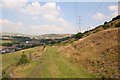
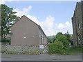
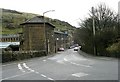

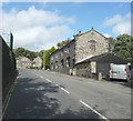
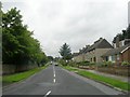
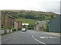

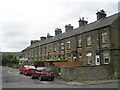
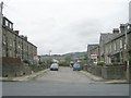
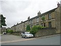
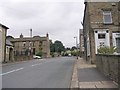
100 photos from this area
Area Information
Key information about the HX2 9UN including its size, population, and administrative classification.
- Area Type
- Postcode
- Area Size
- 6.6 hectares
- Population
- 1507
- Population Density
- 946 people/km²
House Prices in HX2 9UN
52
Properties
£146,595
Average Sold Price
£38,400
Lowest Price
£305,000
Highest Price
Showing 52 properties
| Address | Type | Beds | Baths | Last Sale Price | Last Sale Date | |
|---|---|---|---|---|---|---|
| 62 Heathy Lane, Holmfield, Halifax, HX2 9UN | house | - | - | £170,000 | Jul 2025 | |
| 1 Heathy Lane, Holmfield, Halifax, HX2 9UN | Terraced | 2 | 1 | £91,320 | Aug 2024 | |
| 54 Heathy Lane, Holmfield, Halifax, HX2 9UN | house | 3 | 1 | £180,000 | Jun 2024 | |
| 7 Heathy Lane, Holmfield, Halifax, HX2 9UN | house | - | - | £305,000 | Nov 2022 | |
| 2, Ashdale, Heathy Lane, Holmfield, Halifax, HX2 9UN | house | - | - | £300,000 | Jul 2022 | |
| 58 Heathy Lane, Holmfield, Halifax, HX2 9UN | Retail | 3 | 1 | £160,000 | Mar 2022 | |
| 30 Heathy Lane, Holmfield, Halifax, HX2 9UN | Semi-detached | 2 | 1 | £140,000 | Oct 2019 | |
| 4, Ashdale, Heathy Lane, Holmfield, Halifax, HX2 9UN | Semi-detached | 5 | 3 | £235,000 | Jan 2017 | |
| 5, Sunny Bank, Heathy Lane, Holmfield, Halifax, HX2 9UN | house | - | - | £161,501 | Mar 2016 | |
| 20 Heathy Lane, Holmfield, Halifax, HX2 9UN | Semi-detached | - | - | £163,000 | May 2008 |
Page 1 of 6
Energy Efficiency in HX2 9UN
Amenities
Schools
| Rank | School | Type | Entry gender | Ages |
|---|
Explore more schools in this area
Go to Schools tabDemographics
Household Size
Family (3-5 people)
most common
Accommodation Type
Houses
most common
Tenure
74
majority
Ethnic Group
White
most common
Religion
N/A
most common
Household Composition
N/A
most common
Age
47
median
Adults (30-64 years)
most common
Household Deprivation
N/A
with no deprivation
NS-SEC
32
in Lower managerial occupations
Explore more demographic insights in this area
Go to Demographics tabPlanning
Planning Constraints
- Flood RiskPremium
- Ramsar Wetland SitesPremium
- Area of Outstanding Natural BeautyPremium
- Protected Nature ReservePremium
- Protected WoodlandPremium