Area Overview for HX2 8TS
Photos of HX2 8TS
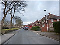
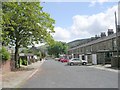
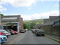
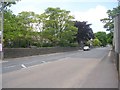
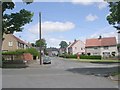
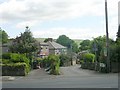
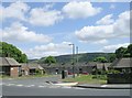
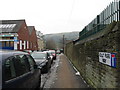
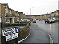
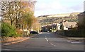
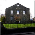

100 photos from this area
Area Information
Key information about the HX2 8TS including its size, population, and administrative classification.
- Area Type
- Postcode
- Area Size
- 4.8 hectares
- Population
- 1659
- Population Density
- 2523 people/km²
House Prices in HX2 8TS
21
Properties
£120,403
Average Sold Price
£44,500
Lowest Price
£300,000
Highest Price
Showing 21 properties
| Address | Type | Beds | Baths | Last Sale Price | Last Sale Date | |
|---|---|---|---|---|---|---|
| 6 Page Hill, Wheatley, Halifax, HX2 8TS | Terraced | 2 | 1 | £140,500 | Apr 2025 | |
| 22 Page Hill, Wheatley, Halifax, HX2 8TS | Terraced | 2 | 1 | £137,500 | Mar 2024 | |
| 25 Page Hill, Wheatley, Halifax, HX2 8TS | Terraced | 2 | 1 | £105,000 | Dec 2022 | |
| 5 Page Hill, Wheatley, Halifax, HX2 8TS | house | - | - | £145,000 | Nov 2022 | |
| 30 Page Hill, Wheatley, Halifax, HX2 8TS | Bungalow | 3 | 2 | £300,000 | Feb 2016 | |
| 15-16 Page Hill, Wheatley, Halifax, HX2 8TS | house | - | - | £87,000 | Feb 2016 | |
| 29 Page Hill, Wheatley, Halifax, HX2 8TS | house | - | - | £187,000 | Nov 2012 | |
| 19 Page Hill, Wheatley, Halifax, HX2 8TS | Terraced | 2 | 1 | £99,000 | Feb 2011 | |
| 17 Page Hill, Wheatley, Halifax, HX2 8TS | house | - | - | £119,995 | Oct 2009 | |
| 3 Page Hill, Wheatley, Halifax, HX2 8TS | house | - | - | £68,000 | Oct 2003 |
Page 1 of 3
Energy Efficiency in HX2 8TS
Amenities
Schools
| Rank | School | Type | Entry gender | Ages |
|---|
Explore more schools in this area
Go to Schools tabDemographics
Household Size
Two person
most common
Accommodation Type
Houses
most common
Tenure
87
majority
Ethnic Group
White
most common
Religion
N/A
most common
Household Composition
N/A
most common
Age
47
median
Adults (30-64 years)
most common
Household Deprivation
N/A
with no deprivation
NS-SEC
33
in Lower managerial occupations
Explore more demographic insights in this area
Go to Demographics tabPlanning
Planning Constraints
- Flood RiskPremium
- Ramsar Wetland SitesPremium
- Area of Outstanding Natural BeautyPremium
- Protected Nature ReservePremium
- Protected WoodlandPremium