Area Overview for HX2 6PD
Photos of HX2 6PD
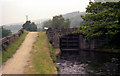

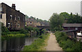

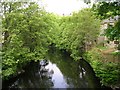
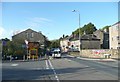
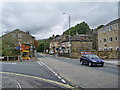
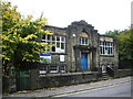
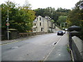
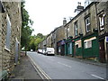
100 photos from this area
Area Information
Key information about the HX2 6PD including its size, population, and administrative classification.
- Area Type
- Postcode
- Area Size
- 3.0 hectares
- Population
- 1621
- Population Density
- 1606 people/km²
House Prices in HX2 6PD
53
Properties
£136,536
Average Sold Price
£59,000
Lowest Price
£220,000
Highest Price
Showing 53 properties
| Address | Type | Beds | Baths | Last Sale Price | Last Sale Date | |
|---|---|---|---|---|---|---|
| 26A Kershaw Drive, Luddenden Foot, Sowerby Bridge, HX2 6PD | Detached | 3 | - | £220,000 | Dec 2021 | |
| 30 Kershaw Drive, Luddenden Foot, Sowerby Bridge, HX2 6PD | Detached | 3 | 1 | £170,000 | Jun 2018 | |
| 28 Kershaw Drive, Luddenden Foot, Sowerby Bridge, HX2 6PD | house | - | - | £168,000 | Apr 2018 | |
| 27 Kershaw Drive, Luddenden Foot, Sowerby Bridge, HX2 6PD | Semi-detached | 3 | 2 | £200,500 | Mar 2018 | |
| 32 Kershaw Drive, Luddenden Foot, Sowerby Bridge, HX2 6PD | Detached | - | - | £70,250 | Aug 2000 | |
| 36 Kershaw Drive, Luddenden Foot, Sowerby Bridge, HX2 6PD | house | - | - | £68,000 | Jun 1999 | |
| 22 Kershaw Drive, Luddenden Foot, Sowerby Bridge, HX2 6PD | Detached | 2 | 1 | £59,000 | Jan 1999 | |
| 26 Kershaw Drive, Luddenden Foot, Sowerby Bridge, HX2 6PD | Detached | 3 | 1 | - | - | |
| Luddenden Youth Centre, Kershaw Drive, Luddenden Foot, Sowerby Bridge, HX2 6PD | commercial | - | - | - | - | |
| 1A Kershaw Drive, Luddenden Foot, Sowerby Bridge, HX2 6PD | Flat | - | - | - | - |
Page 1 of 6
Energy Efficiency in HX2 6PD
Amenities
Schools
| Rank | School | Type | Entry gender | Ages |
|---|
Explore more schools in this area
Go to Schools tabDemographics
Household Size
One person
most common
Accommodation Type
Houses
most common
Tenure
59
majority
Ethnic Group
White
most common
Religion
N/A
most common
Household Composition
N/A
most common
Age
47
median
Adults (30-64 years)
most common
Household Deprivation
N/A
with no deprivation
NS-SEC
34
in Lower managerial occupations
Explore more demographic insights in this area
Go to Demographics tabPlanning
Planning Constraints
- Flood RiskPremium
- Ramsar Wetland SitesPremium
- Area of Outstanding Natural BeautyPremium
- Protected Nature ReservePremium
- Protected WoodlandPremium