Area Overview for HX2 6BJ
Photos of HX2 6BJ
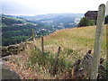
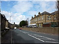
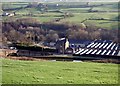
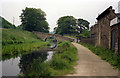

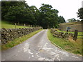
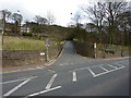
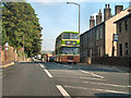
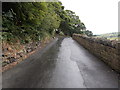
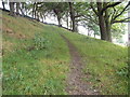
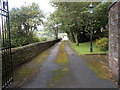
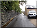
94 photos from this area
Area Information
Key information about the HX2 6BJ including its size, population, and administrative classification.
- Area Type
- Postcode
- Area Size
- 1.3 hectares
- Population
- 1815
- Population Density
- 892 people/km²
House Prices in HX2 6BJ
30
Properties
£111,032
Average Sold Price
£30,000
Lowest Price
£218,000
Highest Price
Showing 30 properties
| Address | Type | Beds | Baths | Last Sale Price | Last Sale Date | |
|---|---|---|---|---|---|---|
| 31 Warley Wood Avenue, Luddenden Foot, Sowerby Bridge, HX2 6BJ | Terraced | 3 | 1 | £114,000 | Aug 2025 | |
| 27 Warley Wood Avenue, Luddenden Foot, Sowerby Bridge, HX2 6BJ | house | - | - | £218,000 | Aug 2024 | |
| 40 Warley Wood Avenue, Luddenden Foot, Sowerby Bridge, HX2 6BJ | Terraced | 3 | 2 | £202,500 | Jul 2024 | |
| 34 Warley Wood Avenue, Luddenden Foot, Sowerby Bridge, HX2 6BJ | Semi-detached | 3 | 1 | £210,000 | Nov 2023 | |
| 26 Warley Wood Avenue, Luddenden Foot, Sowerby Bridge, HX2 6BJ | Terraced | 3 | 1 | £142,500 | Mar 2023 | |
| 24 Warley Wood Avenue, Luddenden Foot, Sowerby Bridge, HX2 6BJ | house | - | - | £114,000 | Mar 2022 | |
| 23 Warley Wood Avenue, Luddenden Foot, Sowerby Bridge, HX2 6BJ | Terraced | 2 | 1 | £127,000 | Aug 2021 | |
| 21 Warley Wood Avenue, Luddenden Foot, Sowerby Bridge, HX2 6BJ | Terraced | 2 | 1 | £140,000 | Jan 2021 | |
| 36 Warley Wood Avenue, Luddenden Foot, Sowerby Bridge, HX2 6BJ | Terraced | 3 | 1 | £165,000 | May 2018 | |
| 29 Warley Wood Avenue, Luddenden Foot, Sowerby Bridge, HX2 6BJ | house | 3 | 1 | £162,000 | Dec 2017 |
Page 1 of 3
Energy Efficiency in HX2 6BJ
Amenities
Schools
| Rank | School | Type | Entry gender | Ages |
|---|
Explore more schools in this area
Go to Schools tabDemographics
Household Size
Two person
most common
Accommodation Type
Houses
most common
Tenure
77
majority
Ethnic Group
White
most common
Religion
N/A
most common
Household Composition
N/A
most common
Age
47
median
Adults (30-64 years)
most common
Household Deprivation
N/A
with no deprivation
NS-SEC
38
in Lower managerial occupations
Explore more demographic insights in this area
Go to Demographics tabPlanning
Planning Constraints
- Flood RiskPremium
- Ramsar Wetland SitesPremium
- Area of Outstanding Natural BeautyPremium
- Protected Nature ReservePremium
- Protected WoodlandPremium