Area Overview for HX1 4JG
Photos of HX1 4JG
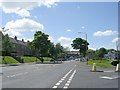
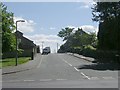
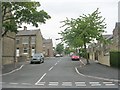
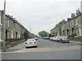
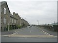
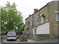
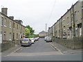
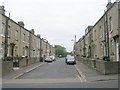
100 photos from this area
Area Information
Key information about the HX1 4JG including its size, population, and administrative classification.
- Area Type
- Postcode
- Area Size
- 2.2 hectares
- Population
- 2413
- Population Density
- 7842 people/km²
House Prices in HX1 4JG
45
Properties
£173,198
Average Sold Price
£37,500
Lowest Price
£2,375,000
Highest Price
Showing 45 properties
| Address | Type | Beds | Baths | Last Sale Price | Last Sale Date | |
|---|---|---|---|---|---|---|
| 209 Spring Hall Lane, Halifax, HX1 4JG | Terraced | 2 | 1 | £122,000 | Jun 2025 | |
| 199 Spring Hall Lane, Halifax, HX1 4JG | house | - | - | £82,000 | Apr 2025 | |
| 191 Spring Hall Lane, Halifax, HX1 4JG | house | - | - | £70,000 | Feb 2024 | |
| 173 Spring Hall Lane, Halifax, HX1 4JG | Flat | 2 | 1 | £2,375,000 | Dec 2023 | |
| 194 Spring Hall Lane, Halifax, HX1 4JG | house | - | - | £115,000 | Sep 2021 | |
| 182 Spring Hall Lane, Halifax, HX1 4JG | house | - | - | £110,000 | Mar 2021 | |
| 193 Spring Hall Lane, Halifax, HX1 4JG | Terraced | 2 | 1 | £75,000 | Oct 2018 | |
| 201 Spring Hall Lane, Halifax, HX1 4JG | Terraced | 3 | 1 | £92,000 | Aug 2017 | |
| 196 Spring Hall Lane, Halifax, HX1 4JG | Semi-detached | 2 | - | £82,000 | Mar 2017 | |
| 206 Spring Hall Lane, Halifax, HX1 4JG | Flat | 1 | 1 | £95,000 | Feb 2017 |
Page 1 of 5
Energy Efficiency in HX1 4JG
Amenities
Schools
| Rank | School | Type | Entry gender | Ages |
|---|
Explore more schools in this area
Go to Schools tabDemographics
Household Size
Family (3-5 people)
most common
Accommodation Type
Houses
most common
Tenure
63
majority
Ethnic Group
asian_total
most common
Religion
N/A
most common
Household Composition
N/A
most common
Age
22
median
Adults (30-64 years)
most common
Household Deprivation
N/A
with no deprivation
NS-SEC
13
in Lower managerial occupations
Explore more demographic insights in this area
Go to Demographics tabPlanning
Planning Constraints
- Flood RiskPremium
- Ramsar Wetland SitesPremium
- Area of Outstanding Natural BeautyPremium
- Protected Nature ReservePremium
- Protected WoodlandPremium