Area Overview for HX1 1EJ
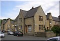
Photos of HX1 1EJ


Area Information
HX1 1EJ is a small, tightly knit residential postcode in England with a population of 1943. It is a quiet, low-density area where most properties are houses, reflecting a community characterised by stability and long-term residency. The median age of 47 suggests a mature demographic, with adults aged 30–64 forming the majority. This area is not defined by sprawling urban sprawl but by its proximity to key amenities and transport links. Residents benefit from nearby schools, including the outstanding-rated All Saints’ CofE Primary School, and practical access to railway stations such as Halifax and Sowerby Bridge. Daily life here balances suburban comfort with accessibility to retail hubs like Tesco Halifax and Co-op Greetland. The low crime risk score of 71 and absence of environmental constraints make it a safe, unobtrusive place to live. While the area lacks natural landmarks or protected sites, its simplicity and functional layout appeal to those seeking a settled, community-focused environment. HX1 1EJ is not a place for grandeur but for reliability—a small postcode where the essentials are met without excess.
- Area Type
- Postcode
- Area Size
- Not available
- Population
- 1943
- Population Density
- 3136 people/km²
The property market in HX1 1EJ is dominated by owner-occupied homes, with 79% of properties in private hands. This high rate of home ownership indicates a community where long-term residency is common, and the housing stock is largely composed of houses rather than flats. The small size of the postcode means the available properties are limited, creating a niche market for buyers. The absence of rental data suggests this is not a hotspot for investors or tenants, though the presence of nearby railway stations could support commuter buyers. For those considering purchase, the area’s compact nature means proximity to amenities and schools is a key selling point. However, the limited housing stock may mean competition for available properties. Buyers should focus on the practical advantages: a safe environment, reliable transport links, and proximity to essential services. This is not a place for speculative growth but for those seeking a stable, low-maintenance home.
House Prices in HX1 1EJ
No properties found in this postcode.
Energy Efficiency in HX1 1EJ
Living in HX1 1EJ offers a blend of convenience and simplicity, with nearby amenities that cater to everyday needs. The retail sector includes major chains such as Tesco Halifax and Co-op Greetland, providing access to groceries, household essentials, and other services. While the area does not have a dense network of parks or leisure facilities, its proximity to railway stations enhances mobility, allowing residents to explore larger urban centres for dining, entertainment, or cultural activities. The presence of multiple railway stations also supports a commuter lifestyle, reducing the need for extensive local amenities. For those who value practicality over luxury, HX1 1EJ’s straightforward approach to lifestyle—prioritising accessibility and reliability—provides a clear advantage. The character of the area is defined by its functional, no-frills offerings, which align with the preferences of its mature, home-owning residents.
Amenities
Schools
HX1 1EJ is served by a range of educational institutions, including All Saints’ CofE Primary School, which holds an outstanding Ofsted rating. This primary school provides a strong foundation for younger children, while the area’s proximity to Ravenscliffe High School and Bermerside School caters to students with special educational needs. The mix of school types reflects a commitment to inclusive education, ensuring families have options regardless of their children’s requirements. All Saints’ CofE Primary’s high rating is a significant advantage for parents prioritising academic standards, though the absence of secondary schools within the postcode means older children may need to commute. The presence of special schools also suggests the area is well-suited to families with diverse needs. For those valuing educational quality and accessibility, HX1 1EJ offers a balanced approach, combining high standards with practical considerations.
| Rank | School | Type | Entry gender | Ages |
|---|
Explore more schools in this area
Go to Schools tabDemographics
The population of HX1 1EJ is 1943, with a median age of 47, indicating a predominantly adult community. The most common age range is 30–64 years, suggesting a mix of middle-aged families and professionals. Home ownership is high, with 79% of residents owning their homes, a figure that points to long-term residency and financial stability. The area is characterised by houses rather than flats, reflecting a preference for single-family living. The predominant ethnic group is White, which aligns with the broader demographic trends of the region. This composition fosters a cohesive, low-turnover community where social ties are likely to be strong. The absence of specific data on deprivation or diversity means the area’s inclusivity cannot be assessed, but the high home ownership and age profile suggest a relatively affluent, settled population. For those prioritising stability and a mature demographic, HX1 1EJ offers a clear profile of what to expect.
Household Size
Accommodation Type
Tenure
Ethnic Group
Religion
Household Composition
Age
Household Deprivation
NS-SEC
Explore more demographic insights in this area
Go to Demographics tabPlanning
Planning Constraints
- Flood RiskPremium
- Ramsar Wetland SitesPremium
- Area of Outstanding Natural BeautyPremium
- Protected Nature ReservePremium
- Protected WoodlandPremium