Area Overview for HX1 1AA
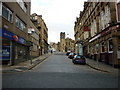
Photos of HX1 1AA


Area Information
HX1 1AA is a compact residential postcode area in England, covering 8,594 square metres and home to 1,306 residents. Its high population density of 151,968 people per square kilometre reflects its small, tightly knit character. This area is defined by its proximity to key infrastructure, including multiple railway stations and retail hubs, making it practical for daily commutes and errands. The community is predominantly composed of adults aged 30–64, with a median age of 47. While the area lacks natural landscapes or protected sites, its strategic location near urban amenities offers convenience. Residents benefit from nearby rail links and a range of shops, though the housing stock is limited to flats, reflecting a rental-focused market. For those seeking a compact, connected living environment with access to transport and retail, HX1 1AA provides a functional base, though its small size means choices are constrained.
- Area Type
- Postcode
- Area Size
- 8594 m²
- Population
- 1306
- Population Density
- 1771 people/km²
The property market in HX1 1AA is characterised by a 11% home ownership rate, indicating that the majority of residents are renters. The area’s accommodation type is exclusively flats, which contrasts with regions where larger homes or detached properties dominate. This suggests a market skewed towards short-term tenancies and limited scope for property investment. The small area size of 8,594 square metres further restricts housing stock, making it challenging for buyers seeking owner-occupied homes. For those considering the area, the lack of varied property types and high rental dependency may limit options. Proximity to rail links and retail amenities could offset the drawbacks of limited housing diversity, but buyers should approach the market with realistic expectations given its constrained nature.
House Prices in HX1 1AA
No properties found in this postcode.
Energy Efficiency in HX1 1AA
HX1 1AA’s lifestyle is shaped by its proximity to retail and transport hubs. Nearby amenities include M&S Halifax, Sainsburys Halifax, and Heron Halifax, offering a range of shopping and dining options. The five rail stations within practical reach enhance accessibility to workplaces, leisure spots, and other services. While the area lacks parks or recreational spaces in the provided data, its compact design ensures residents can reach essential services quickly. The mix of retail and transport infrastructure supports a practical, convenience-driven lifestyle, ideal for those prioritising ease of access over expansive green spaces. The limited availability of leisure facilities, however, may require residents to travel further for activities beyond shopping and commuting.
Amenities
Schools
The nearest educational institution to HX1 1AA is Trinity Sixth Form Academy, a sixth-form college catering to older students. No primary or secondary schools are listed in the data, which may require families with younger children to seek alternatives in nearby areas. The absence of schools within the immediate vicinity suggests that the area is more suited to those with older dependents or those commuting to education elsewhere. For families prioritising a comprehensive school network, HX1 1AA’s current provision may not fully meet their needs, though the presence of a sixth-form college could be a benefit for students nearing higher education.
| Rank | School | Type | Entry gender | Ages |
|---|
Explore more schools in this area
Go to Schools tabDemographics
The population of HX1 1AA is predominantly adults aged 30–64, with a median age of 47. Home ownership is exceptionally low at 11%, indicating a rental-heavy market. The accommodation type is exclusively flats, reflecting a lack of larger properties or family homes. The predominant ethnic group is White, with no data provided on other demographics. The high population density of 151,968 people per square kilometre suggests a concentrated community, which may impact living space and shared resources. While the area’s demographics do not indicate significant deprivation, the limited home ownership and flat-based housing suggest a transient or younger population. This profile aligns with a community prioritising convenience over long-term residency, shaped by the area’s compact size and urban connectivity.
Household Size
Accommodation Type
Tenure
Ethnic Group
Religion
Household Composition
Age
Household Deprivation
NS-SEC
Explore more demographic insights in this area
Go to Demographics tabPlanning
Planning Constraints
- Flood RiskPremium
- Ramsar Wetland SitesPremium
- Area of Outstanding Natural BeautyPremium
- Protected Nature ReservePremium
- Protected WoodlandPremium