Area Overview for HU9 4SF
Photos of HU9 4SF
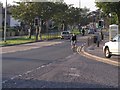
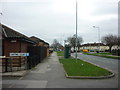

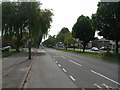
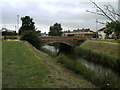
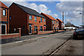
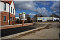
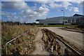
100 photos from this area
Area Information
Key information about the HU9 4SF including its size, population, and administrative classification.
- Area Type
- Postcode
- Area Size
- 5354 m²
- Population
- 1269
- Population Density
- 6551 people/km²
House Prices in HU9 4SF
23
Properties
£44,208
Average Sold Price
£7,875
Lowest Price
£90,000
Highest Price
Showing 23 properties
| Address | Type | Beds | Baths | Last Sale Price | Last Sale Date | |
|---|---|---|---|---|---|---|
| 11 St Georges Walk, Kingston Upon Hull, HU9 4SF | Flat | - | - | £47,500 | Aug 2023 | |
| 9 St Georges Walk, Kingston Upon Hull, HU9 4SF | Flat | - | - | £55,000 | Jun 2023 | |
| 21 St Georges Walk, Kingston Upon Hull, HU9 4SF | Flat | - | - | £25,000 | May 2023 | |
| 12 St Georges Walk, Kingston Upon Hull, HU9 4SF | Bungalow | 2 | 1 | £82,000 | Oct 2022 | |
| 4 St Georges Walk, Kingston Upon Hull, HU9 4SF | Bungalow | 2 | 1 | £80,000 | Jul 2022 | |
| 14 St Georges Walk, Kingston Upon Hull, HU9 4SF | Bungalow | - | - | £90,000 | Mar 2022 | |
| 22 St Georges Walk, Kingston Upon Hull, HU9 4SF | Flat | - | - | £42,000 | Dec 2021 | |
| 23 St Georges Walk, Kingston Upon Hull, HU9 4SF | Flat | 2 | 1 | £40,000 | Sep 2021 | |
| 13 St Georges Walk, Kingston Upon Hull, HU9 4SF | Bungalow | 2 | 1 | £62,000 | Nov 2017 | |
| 18 St Georges Walk, Kingston Upon Hull, HU9 4SF | Flat | - | - | £53,000 | Nov 2017 |
Page 1 of 3
Energy Efficiency in HU9 4SF
Amenities
Schools
| Rank | School | Type | Entry gender | Ages |
|---|
Explore more schools in this area
Go to Schools tabDemographics
Household Size
One person
most common
Accommodation Type
Houses
most common
Tenure
22
majority
Ethnic Group
White
most common
Religion
N/A
most common
Household Composition
N/A
most common
Age
47
median
Adults (30-64 years)
most common
Household Deprivation
N/A
with no deprivation
NS-SEC
11
in Lower managerial occupations
Explore more demographic insights in this area
Go to Demographics tabPlanning
Planning Constraints
- Flood RiskPremium
- Ramsar Wetland SitesPremium
- Area of Outstanding Natural BeautyPremium
- Protected Nature ReservePremium
- Protected WoodlandPremium