Area Overview for HU9 4DG
Photos of HU9 4DG
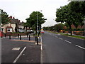
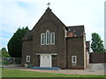
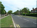
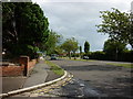
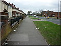
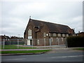

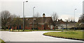
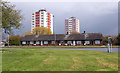
100 photos from this area
Area Information
Key information about the HU9 4DG including its size, population, and administrative classification.
- Area Type
- Postcode
- Area Size
- 2.9 hectares
- Population
- 1638
- Population Density
- 2076 people/km²
House Prices in HU9 4DG
88
Properties
£163,836
Average Sold Price
£68,984
Lowest Price
£205,995
Highest Price
Showing 88 properties
| Address | Type | Beds | Baths | Last Sale Price | Last Sale Date | |
|---|---|---|---|---|---|---|
| 145 Waudby Way, Kingston Upon Hull, HU9 4DG | Terraced | 2 | 1 | £137,000 | Jun 2023 | |
| 7 Waudby Way, Kingston Upon Hull, HU9 4DG | Detached | 3 | 2 | £146,997 | Mar 2023 | |
| 125 Waudby Way, Kingston Upon Hull, HU9 4DG | house | - | - | £205,995 | Dec 2022 | |
| 127 Waudby Way, Kingston Upon Hull, HU9 4DG | house | - | - | £205,995 | Dec 2022 | |
| 121 Waudby Way, Kingston Upon Hull, HU9 4DG | house | - | - | £201,995 | Oct 2022 | |
| 123 Waudby Way, Kingston Upon Hull, HU9 4DG | house | - | - | £201,995 | Oct 2022 | |
| 117 Waudby Way, Kingston Upon Hull, HU9 4DG | Semi-detached | 3 | 2 | £169,995 | Sep 2022 | |
| 119 Waudby Way, Kingston Upon Hull, HU9 4DG | house | - | - | £165,995 | Sep 2022 | |
| 113 Waudby Way, Kingston Upon Hull, HU9 4DG | Detached | 3 | 2 | £163,995 | Sep 2022 | |
| 115 Waudby Way, Kingston Upon Hull, HU9 4DG | house | - | - | £163,995 | Sep 2022 |
Page 1 of 9
Energy Efficiency in HU9 4DG
Amenities
Schools
| Rank | School | Type | Entry gender | Ages |
|---|
Explore more schools in this area
Go to Schools tabDemographics
Household Size
Family (3-5 people)
most common
Accommodation Type
Houses
most common
Tenure
29
majority
Ethnic Group
White
most common
Religion
N/A
most common
Household Composition
N/A
most common
Age
47
median
Adults (30-64 years)
most common
Household Deprivation
N/A
with no deprivation
NS-SEC
11
in Lower managerial occupations
Explore more demographic insights in this area
Go to Demographics tabPlanning
Planning Constraints
- Flood RiskPremium
- Ramsar Wetland SitesPremium
- Area of Outstanding Natural BeautyPremium
- Protected Nature ReservePremium
- Protected WoodlandPremium