Area Overview for HU9 3YY
Photos of HU9 3YY


Area Information
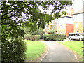
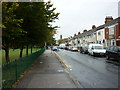
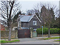
Living in HU9 3YY offers a compact, residential experience shaped by its small cluster of homes and proximity to essential services. With a population of 2172, the area caters to a mature demographic, predominantly adults aged 30-64, reflecting a community rooted in stability. The postcode’s housing stock is largely composed of houses, which aligns with the 50% home ownership rate, suggesting a balance between owner-occupied properties and rentals. Daily life here is anchored by nearby amenities, including retail outlets like Asda Hull Hedon and Morrisons Daily, as well as transport links such as Hull Ferry Terminal and multiple rail stations. The area’s modest size means residents are close to schools, shops, and public transport, though its small footprint limits the diversity of local facilities. For those prioritising convenience over sprawling urban sprawl, HU9 3YY provides a straightforward, practical living environment with minimal commute times to larger hubs.
- Area Type
- Postcode
- Area Size
- Not available
- Population
- 2172
- Population Density
- 4601 people/km²
The property market in HU9 3YY is characterised by a 50% home ownership rate, indicating a balance between owner-occupied and rental properties. The area’s housing stock is predominantly houses, which contrasts with regions where flats or apartments dominate. This suggests a preference for single-family homes, appealing to those seeking space and privacy. Given the small size of the postcode, the available properties are limited, meaning buyers may need to consider nearby areas for a broader selection. The mix of ownership and rental options could make the market competitive, particularly for first-time buyers. The absence of high-density housing also means the area is unlikely to attract renters prioritising urban living, though its proximity to transport links may offset this.
House Prices in HU9 3YY
No properties found in this postcode.
Energy Efficiency in HU9 3YY
Residents of HU9 3YY enjoy access to essential amenities within practical reach, including retail outlets such as Asda Hull Hedon, Morrisons Daily, and Iceland Holderness. These stores provide everyday shopping convenience, from groceries to household goods. The area’s transport links, including rail stations and the ferry terminal, enhance mobility, allowing residents to access broader regional services. While the data does not mention parks or leisure facilities, the presence of multiple retail and transport options suggests a functional, practical lifestyle. The compact nature of the area means daily errands are efficient, though those seeking extensive leisure opportunities may need to travel further.
Amenities
Schools
Residents of HU9 3YY have access to two primary schools: Southcoates Primary School and Southcoates Primary Academy. Both institutions cater to young children, though Southcoates Primary Academy holds an Ofsted rating of ‘good’, indicating a higher standard of education. The presence of two primary schools within reach provides families with options, though no secondary schools are listed in the data. For parents, this ensures early education is accessible, but further schooling may require travel to nearby towns. The mix of school types reflects a focus on foundational education, though the lack of detailed performance metrics means outcomes remain unquantified.
| Rank | School | Type | Entry gender | Ages |
|---|
Explore more schools in this area
Go to Schools tabDemographics
The community in HU9 3YY is predominantly composed of adults aged 30-64, with a median age of 47, indicating a mature, established population. Home ownership stands at 50%, suggesting a mix of owner-occupied properties and rental units. The area’s accommodation is largely houses, reflecting a preference for single-family homes over flats or apartments. The predominant ethnic group is White, though no specific data on diversity or deprivation is provided. This age profile implies a population likely focused on long-term stability, with fewer young families or retirees compared to other areas. The lack of detailed diversity metrics means the community’s cultural composition remains unquantified, but the demographic suggests a relatively uniform social structure.
Household Size
Accommodation Type
Tenure
Ethnic Group
Religion
Household Composition
Age
Household Deprivation
NS-SEC
Explore more demographic insights in this area
Go to Demographics tabPlanning
Planning Constraints
- Flood RiskPremium
- Ramsar Wetland SitesPremium
- Area of Outstanding Natural BeautyPremium
- Protected Nature ReservePremium
- Protected WoodlandPremium