Area Overview for HU9 3YR
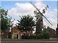
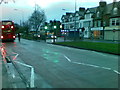
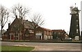
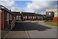
Photos of HU9 3YR


Area Information
Living in HU9 3YR offers a quiet, residential lifestyle in a small cluster of homes in England. With a population of 1,971, the area is compact but well-connected to nearby towns through rail and ferry links. The community is predominantly composed of adults aged 30–64, reflecting a mature demographic. Daily life here is characterised by a balance between local amenities and proximity to larger urban hubs. The area’s housing stock consists mainly of houses, which aligns with the 69% home ownership rate, suggesting a stable, long-term resident base. While the postcode covers a limited geographical footprint, its strategic location near Hull Railway Station and the Hull Ferry Terminal provides easy access to commuting routes. For those seeking a low-maintenance lifestyle with access to essential services, HU9 3YR offers a blend of practicality and convenience. The absence of major environmental constraints, such as protected woodlands or AONB areas, means development pressures are minimal, though the area’s small size means choices for expansion are limited.
- Area Type
- Postcode
- Area Size
- Not available
- Population
- 1971
- Population Density
- 5402 people/km²
The property market in HU9 3YR is dominated by owner-occupied homes, with 69% of properties owned by residents rather than rented. This high home ownership rate suggests a community of long-term residents, many of whom may have purchased their homes in the area’s limited housing stock. The accommodation type is exclusively houses, which contrasts with areas where flats or apartments are more common. This means the market is unlikely to cater to short-term renters or those seeking smaller properties. For buyers, the small size of the postcode area means the housing stock is limited, though the presence of nearby rail and ferry links may make the area attractive for commuters. The absence of rental properties or newer developments implies that the market is relatively static, with few opportunities for investment or speculative buying. Those considering purchase here should focus on the existing housing stock and its alignment with their long-term needs.
House Prices in HU9 3YR
No properties found in this postcode.
Energy Efficiency in HU9 3YR
The lifestyle in HU9 3YR is shaped by its proximity to essential amenities. Retail options include Morrisons Southcoates, Morrisons Daily, and Farmfoods Southcoates, providing access to grocery shopping and everyday essentials. The Hull Ferry Terminal offers a gateway to water-based travel, while five nearby railway stations—such as Hull Railway Station and New Holland Railway Station—connect residents to broader networks. Though the area lacks parks or leisure facilities within the postcode, the surrounding region likely offers recreational opportunities. The convenience of nearby retail and transport hubs makes daily life efficient, with minimal need to travel far for shopping or commuting. The character of the area is defined by its practicality, with amenities focused on functionality rather than luxury. This makes HU9 3YR appealing to those prioritising accessibility over expansive leisure options.
Amenities
Schools
The schools near HU9 3YR include two primary institutions: Alderman Cogan’s CofE Primary School and Alderman Cogan’s Church of England Primary Academy. Both are primary schools, with the latter holding an Ofsted rating of ‘good’. This suggests a focus on early education, though no secondary schools are listed in the data. The presence of two primary schools may indicate a localised catchment area, potentially serving families with young children. However, the absence of secondary school data means parents may need to look further afield for secondary education. The ‘good’ rating at one school provides a positive benchmark, but the lack of variety in school types—only primary—means families should consider proximity to other educational institutions outside the immediate area. For those prioritising primary education, the schools in HU9 3YR offer a basic framework, but further research is needed for secondary options.
| Rank | School | Type | Entry gender | Ages |
|---|
Explore more schools in this area
Go to Schools tabDemographics
The community in HU9 3YR is largely composed of adults aged 30–64, with a median age of 47. This suggests a population that is settled, with fewer young families or elderly residents compared to other areas. The 69% home ownership rate indicates a strong presence of long-term residents, many of whom are likely to have purchased their homes rather than rented. The predominant ethnic group is White, though specific data on diversity is not provided. The area’s housing stock is exclusively houses, which may reflect a preference for family homes or larger properties. With no data on deprivation or household composition, it is unclear how socioeconomic factors influence daily life. However, the absence of protected natural areas or planning constraints implies a relatively straightforward regulatory environment for residents. The age profile and home ownership figures suggest a community that values stability and continuity, with limited turnover of residents.
Household Size
Accommodation Type
Tenure
Ethnic Group
Religion
Household Composition
Age
Household Deprivation
NS-SEC
Explore more demographic insights in this area
Go to Demographics tabPlanning
Planning Constraints
- Flood RiskPremium
- Ramsar Wetland SitesPremium
- Area of Outstanding Natural BeautyPremium
- Protected Nature ReservePremium
- Protected WoodlandPremium