Area Overview for HU9 3JF
Photos of HU9 3JF
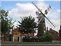
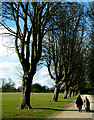
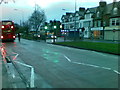
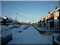


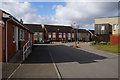
100 photos from this area
Area Information
Key information about the HU9 3JF including its size, population, and administrative classification.
- Area Type
- Postcode
- Area Size
- 8701 m²
- Population
- 1971
- Population Density
- 5402 people/km²
House Prices in HU9 3JF
21
Properties
£67,279
Average Sold Price
£22,000
Lowest Price
£121,000
Highest Price
Showing 21 properties
| Address | Type | Beds | Baths | Last Sale Price | Last Sale Date | |
|---|---|---|---|---|---|---|
| 84 Portobello Street, Kingston Upon Hull, HU9 3JF | house | - | - | £121,000 | Oct 2021 | |
| 72 Portobello Street, Kingston Upon Hull, HU9 3JF | Semi-detached | 2 | 1 | £73,000 | Aug 2018 | |
| 58 Portobello Street, Kingston Upon Hull, HU9 3JF | Terraced | 3 | 1 | £73,000 | May 2017 | |
| 74 Portobello Street, Kingston Upon Hull, HU9 3JF | house | - | - | £75,000 | Mar 2016 | |
| 86 Portobello Street, Kingston Upon Hull, HU9 3JF | Semi-detached | - | - | £80,000 | Jul 2014 | |
| 76 Portobello Street, Kingston Upon Hull, HU9 3JF | house | - | - | £100,000 | Apr 2010 | |
| 70 Portobello Street, Kingston Upon Hull, HU9 3JF | Detached | 3 | 2 | £74,000 | Sep 2007 | |
| 62 Portobello Street, Kingston Upon Hull, HU9 3JF | house | 3 | 1 | £77,838 | Jul 2006 | |
| Demolished, 90 Portobello Street, Kingston Upon Hull, HU9 3JF | Semi-detached | - | - | £94,000 | Mar 2006 | |
| 60 Portobello Street, Kingston Upon Hull, HU9 3JF | Terraced | - | - | £59,950 | Nov 2003 |
Page 1 of 3
Energy Efficiency in HU9 3JF
Amenities
Schools
| Rank | School | Type | Entry gender | Ages |
|---|
Explore more schools in this area
Go to Schools tabDemographics
Household Size
Family (3-5 people)
most common
Accommodation Type
Houses
most common
Tenure
69
majority
Ethnic Group
White
most common
Religion
N/A
most common
Household Composition
N/A
most common
Age
47
median
Adults (30-64 years)
most common
Household Deprivation
N/A
with no deprivation
NS-SEC
22
in Lower managerial occupations
Explore more demographic insights in this area
Go to Demographics tabPlanning
Planning Constraints
- Flood RiskPremium
- Ramsar Wetland SitesPremium
- Area of Outstanding Natural BeautyPremium
- Protected Nature ReservePremium
- Protected WoodlandPremium