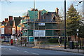
Area Overview for HU9 3DB
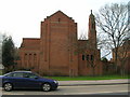
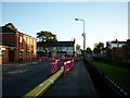
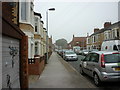
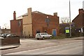
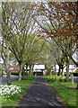
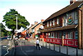
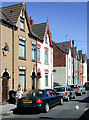
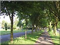
Photos of HU9 3DB


Area Information
Living in HU9 3DB means being part of a small, tightly knit residential cluster in England with a population of 1386. This area is characterised by its modest scale and proximity to essential services, making it practical for those seeking a balance between privacy and accessibility. The community is predominantly composed of adults aged 30-64, with a median age of 47, suggesting a mature, stable population. Daily life here is shaped by the surrounding infrastructure, including nearby retail hubs, rail networks, and the Hull Ferry Terminal. While the area is compact, it offers a range of amenities within practical reach, from supermarkets to railway stations. The presence of two primary schools, including one with an outstanding Ofsted rating, underscores its appeal to families. However, the small size of HU9 3DB means that its housing stock and services are limited to immediate needs, requiring residents to look slightly beyond the postcode for broader options.
- Area Type
- Postcode
- Area Size
- Not available
- Population
- 1386
- Population Density
- 7245 people/km²
The property market in HU9 3DB is defined by its small scale and the prevalence of houses. With a home ownership rate of 36%, the area is not heavily dominated by owner-occupied properties, suggesting a notable presence of rental housing. The accommodation type being primarily houses indicates a focus on traditional, family-friendly homes rather than apartments or flats. This could be advantageous for buyers seeking larger living spaces, though the limited number of properties in the area means competition may be fierce for available homes. The compact nature of HU9 3DB also means that buyers may need to consider nearby areas for more options. For those prioritising a home with space and a sense of permanence, the housing stock here offers a practical, if limited, selection. However, the small size of the area may make it challenging to find properties that meet all criteria without expanding the search radius.
House Prices in HU9 3DB
No properties found in this postcode.
Energy Efficiency in HU9 3DB
The lifestyle in HU9 3DB is shaped by its proximity to essential amenities. Residents can access five retail outlets, including Iceland Holderness, Heron Southcoates, and Asda Mount, providing convenient shopping options. The rail network, with stations such as Hull Railway Station and New Holland Railway Station, facilitates commuting to nearby towns and cities. The Hull Ferry Terminal adds another layer of connectivity, potentially useful for those working in or visiting the port area. While the area lacks expansive parks or leisure facilities, the availability of retail and transport hubs suggests a practical, no-frills lifestyle. The presence of multiple supermarkets and rail links indicates that daily needs are met without the need to travel far. However, the limited number of amenities means that residents may need to venture beyond the postcode for more diverse leisure or recreational options.
Amenities
Schools
Residents of HU9 3DB have access to two primary schools within proximity: Craven Primary School and Craven Primary Academy. Both institutions cater to the needs of young children, with Craven Primary Academy holding an outstanding Ofsted rating, a strong indicator of educational quality. The presence of two primary schools within the area ensures that families have options, though the absence of secondary schools nearby means students may need to travel to other areas for further education. The mix of school types reflects a focus on early years education, which is crucial for young families. However, the lack of secondary school provision could be a consideration for those planning long-term stays. The outstanding rating at Craven Primary Academy is a significant positive, offering reassurance about the standard of teaching and facilities available to local children.
| Rank | School | Type | Entry gender | Ages |
|---|
Explore more schools in this area
Go to Schools tabDemographics
The demographic profile of HU9 3DB reflects a population skewed towards adults aged 30-64, with a median age of 47. This suggests a community of established professionals and families, rather than a younger or elderly demographic. Home ownership in the area stands at 36%, indicating a mix of owner-occupied properties and rental units. The accommodation type is predominantly houses, which may appeal to those seeking more space or a traditional living arrangement. The predominant ethnic group is White, though no specific data on diversity or deprivation is provided. The relatively low home ownership rate implies that a significant portion of the population may be renting, potentially affecting the local property market dynamics. The age distribution also suggests a community with a focus on stability, though it may lack the vibrancy of areas with younger populations.
Household Size
Accommodation Type
Tenure
Ethnic Group
Religion
Household Composition
Age
Household Deprivation
NS-SEC
Explore more demographic insights in this area
Go to Demographics tabPlanning
Planning Constraints
- Flood RiskPremium
- Ramsar Wetland SitesPremium
- Area of Outstanding Natural BeautyPremium
- Protected Nature ReservePremium
- Protected WoodlandPremium