Area Overview for HU9 2WB
Photos of HU9 2WB

Area Information
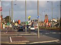
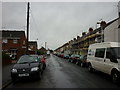
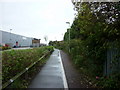
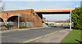
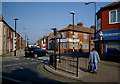
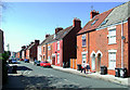
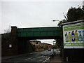
Living in HU9 2WB means being part of a small, tightly knit residential cluster in England, home to 1,560 people. This area is defined by its compact size and the presence of family-oriented housing, with a median age of 47 and a majority of residents aged 30–64. Daily life here is shaped by proximity to local amenities, including retail outlets, rail links, and a ferry terminal. The area’s low flood risk and absence of protected natural sites suggest a relatively straightforward planning environment. However, the high crime risk score of 4/100 indicates residents should remain vigilant. Despite this, the area’s practical connectivity—via multiple railway stations and a direct ferry route to Hull—offers flexibility for commuting or leisure. For those seeking a quiet, residential setting with access to essential services, HU9 2WB balances simplicity with functional infrastructure. Its small footprint means the community is close-knit, with residents likely to know their neighbours. The presence of two primary schools, including one with an outstanding Ofsted rating, adds to its appeal for families.
- Area Type
- Postcode
- Area Size
- Not available
- Population
- 1560
- Population Density
- 9198 people/km²
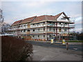
The property market in HU9 2WB is characterised by a low home ownership rate of 34%, suggesting that the majority of housing stock is rented rather than owned. This dynamic positions the area as more of a rental market than an owner-occupied one, which could influence buyer demand and competition for available properties. The accommodation type is predominantly houses, which are typically larger and more suited to families than flats. Given the area’s small size, the housing stock is limited, meaning buyers may find fewer options within HU9 2WB itself. Those considering the area should look beyond its immediate boundaries to explore surrounding regions for a broader selection of properties. The focus on houses also implies that the market caters to those seeking space and privacy, though the rental market’s dominance may affect long-term investment potential.
House Prices in HU9 2WB
No properties found in this postcode.
Energy Efficiency in HU9 2WB
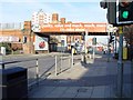
The lifestyle in HU9 2WB is shaped by its accessible amenities, including five retail outlets such as Heron Southcoates, Iceland Holderness, and Asda Mount. These shops provide essentials, from groceries to household goods, reducing the need for long trips to larger centres. The area’s rail connections to Hull and surrounding towns mean residents can easily access cultural, leisure, and professional opportunities beyond the immediate neighbourhood. The ferry terminal adds another layer of convenience, particularly for those who prefer or require maritime travel. While the data does not specify parks or leisure facilities, the presence of multiple retail and transport options suggests a practical, service-oriented lifestyle. The compact nature of the area ensures that amenities are within walking or short driving distance, fostering a sense of convenience and community. This balance of retail, transport, and connectivity makes daily life in HU9 2WB efficient and accessible.
Amenities
Schools
Residents of HU9 2WB have access to two primary schools: Estcourt Primary School and Estcourt Primary Academy. The latter holds an outstanding Ofsted rating, a strong indicator of high-quality education and effective teaching. Both institutions serve the local community, providing essential early years and primary education. The presence of two primary schools, even within a small area, suggests a focus on family-friendly infrastructure. For parents, this means a choice between schools, though the proximity of both to the area ensures convenience. The outstanding rating at Estcourt Primary Academy could be a significant draw for families prioritising academic standards. However, the absence of secondary schools in the data means residents may need to travel further for secondary education. This mix of school types reflects a practical approach to meeting the needs of primary-age children in the area.
| Rank | School | Type | Entry gender | Ages |
|---|
Explore more schools in this area
Go to Schools tabDemographics
The population of HU9 2WB is predominantly adults aged 30–64, with a median age of 47. This suggests a community of established professionals and families, rather than a younger or elderly demographic. Home ownership here is relatively low, with only 34% of residents owning their homes. The remaining 66% are likely to be renting, indicating a rental market that may offer more flexibility for new arrivals. The area is composed almost entirely of houses, rather than flats or apartments, which aligns with its suburban character. The predominant ethnic group is White, reflecting a homogenous demographic profile. While specific data on deprivation is not provided, the low home ownership rate could suggest economic diversity, with some residents relying on rental income or other forms of financial support. The absence of detailed diversity metrics means the community’s cultural composition remains less defined in the data.
Household Size
Accommodation Type
Tenure
Ethnic Group
Religion
Household Composition
Age
Household Deprivation
NS-SEC
Explore more demographic insights in this area
Go to Demographics tabPlanning
Planning Constraints
- Flood RiskPremium
- Ramsar Wetland SitesPremium
- Area of Outstanding Natural BeautyPremium
- Protected Nature ReservePremium
- Protected WoodlandPremium