Area Overview for HU9 2RT
Photos of HU9 2RT
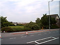
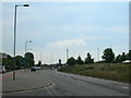
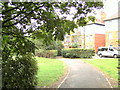
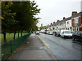


100 photos from this area
Area Information
Key information about the HU9 2RT including its size, population, and administrative classification.
- Area Type
- Postcode
- Area Size
- 1725 m²
- Population
- 1425
- Population Density
- 6170 people/km²
House Prices in HU9 2RT
15
Properties
£58,238
Average Sold Price
£18,000
Lowest Price
£99,950
Highest Price
Showing 15 properties
| Address | Type | Beds | Baths | Last Sale Price | Last Sale Date | |
|---|---|---|---|---|---|---|
| 175 Estcourt Street, Kingston Upon Hull, HU9 2RT | Terraced | 2 | 1 | £99,950 | Jul 2024 | |
| 187 Estcourt Street, Kingston Upon Hull, HU9 2RT | Terraced | 3 | 1 | £60,000 | Jul 2022 | |
| 193 Estcourt Street, Kingston Upon Hull, HU9 2RT | Terraced | 3 | 1 | £60,500 | Jan 2022 | |
| 195 Estcourt Street, Kingston Upon Hull, HU9 2RT | house | - | - | £97,000 | Jan 2022 | |
| 189 Estcourt Street, Kingston Upon Hull, HU9 2RT | Terraced | 3 | 1 | £58,000 | Apr 2019 | |
| 181 Estcourt Street, Kingston Upon Hull, HU9 2RT | Terraced | 2 | - | £61,000 | Jun 2017 | |
| 191 Estcourt Street, Kingston Upon Hull, HU9 2RT | house | 2 | - | £52,000 | Nov 2010 | |
| 199 Estcourt Street, Kingston Upon Hull, HU9 2RT | Terraced | 2 | 1 | £41,500 | Apr 2009 | |
| 179 Estcourt Street, Kingston Upon Hull, HU9 2RT | Terraced | 3 | 1 | £61,500 | Mar 2006 | |
| 177 Estcourt Street, Kingston Upon Hull, HU9 2RT | Terraced | 3 | 1 | £63,250 | Jul 2004 |
Page 1 of 2
Energy Efficiency in HU9 2RT
Amenities
Schools
| Rank | School | Type | Entry gender | Ages |
|---|
Explore more schools in this area
Go to Schools tabDemographics
Household Size
Two person
most common
Accommodation Type
Houses
most common
Tenure
66
majority
Ethnic Group
White
most common
Religion
N/A
most common
Household Composition
N/A
most common
Age
47
median
Adults (30-64 years)
most common
Household Deprivation
N/A
with no deprivation
NS-SEC
16
in Lower managerial occupations
Explore more demographic insights in this area
Go to Demographics tabPlanning
Planning Constraints
- Flood RiskPremium
- Ramsar Wetland SitesPremium
- Area of Outstanding Natural BeautyPremium
- Protected Nature ReservePremium
- Protected WoodlandPremium