Area Overview for HU9 2PQ
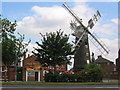
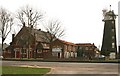
Photos of HU9 2PQ


Area Information
Living in HU9 2PQ means being part of a tightly knit residential cluster in England, home to 1,425 residents. This small area is defined by its modest size and the presence of family-oriented housing. The community is predominantly composed of adults aged 30 to 64, with a median age of 47, suggesting a stable, mature demographic. Daily life here is shaped by proximity to essential services, including retail outlets, rail links, and a ferry terminal. The area’s compact nature means residents can access amenities within a short distance, though its limited size may appeal more to those seeking a quiet, low-traffic environment. With no major environmental constraints or flood risks, HU9 2PQ offers a straightforward, practical living experience. The presence of rail stations like Hull and Cottingham ensures connectivity to nearby towns, while the absence of protected landscapes or wetlands means development is not restricted. For buyers, this area is ideal for those prioritising safety, simplicity, and proximity to transport over sprawling urban or rural settings.
- Area Type
- Postcode
- Area Size
- Not available
- Population
- 1425
- Population Density
- 6170 people/km²
The property market in HU9 2PQ is characterised by a high rate of home ownership (66%) and a focus on houses rather than flats or apartments. This suggests a community where long-term residency is common, with properties likely to be family homes rather than short-term investments. The small area’s limited size means the housing stock is not extensive, which could make the market competitive for buyers. For those seeking owner-occupied properties, this area offers a straightforward option with no planning constraints from protected landscapes or wetlands. However, the lack of diversity in accommodation types and the modest population size mean there are few alternatives nearby. Buyers should consider the area’s compact nature when evaluating its appeal, as it may not cater to those requiring larger or more varied housing options.
House Prices in HU9 2PQ
No properties found in this postcode.
Energy Efficiency in HU9 2PQ
Daily life in HU9 2PQ is supported by a range of nearby amenities, including five retail outlets such as Iceland Holderness, Heron Southcoates, and Morrisons Southcoates. These provide access to grocery shopping and everyday essentials. The area’s proximity to Hull Ferry Terminal and multiple rail stations, including New Holland and Cottingham, ensures easy travel for work, leisure, or commuting. While the data does not mention parks or leisure facilities, the presence of retail and transport hubs suggests a functional, convenience-focused lifestyle. The compact nature of the area means residents can access services without lengthy journeys, though the lack of detailed information on recreational spaces may require further investigation.
Amenities
Schools
The nearest school to HU9 2PQ is David Lister School, a primary institution serving the local community. No secondary schools are listed in the data, so families with older children may need to look beyond the immediate area for comprehensive education. The presence of a primary school indicates that the area is suitable for young families, though parents should verify the availability of secondary education options. The school’s type and performance are not detailed here, but its existence suggests a basic educational infrastructure. For those prioritising proximity to schools, David Lister School provides a practical resource, though additional research may be needed to assess its academic standards.
| Rank | School | Type | Entry gender | Ages |
|---|
Explore more schools in this area
Go to Schools tabDemographics
The population of HU9 2PQ is 1,425, with a median age of 47, indicating a community skewed towards middle-aged adults. The most common age range is 30–64 years, suggesting a mix of established families and professionals. Home ownership is high at 66%, with houses being the predominant type of accommodation. This reflects a settled, long-term resident base rather than a transient rental market. The predominant ethnic group is White, though no further diversity data is provided. The age profile and ownership rates imply a community with a strong sense of continuity. The absence of specific deprivation data means it is not possible to assess socioeconomic challenges, but the high home ownership and mature age group suggest a relatively stable quality of life.
Household Size
Accommodation Type
Tenure
Ethnic Group
Religion
Household Composition
Age
Household Deprivation
NS-SEC
Explore more demographic insights in this area
Go to Demographics tabPlanning
Planning Constraints
- Flood RiskPremium
- Ramsar Wetland SitesPremium
- Area of Outstanding Natural BeautyPremium
- Protected Nature ReservePremium
- Protected WoodlandPremium