Area Overview for HU9 2HH
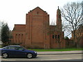
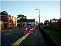
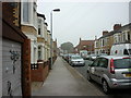
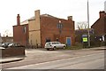
Photos of HU9 2HH


Area Information
Living in HU9 2HH means being part of a small, tightly knit residential cluster in England, home to just 1,386 people. This area is characterised by its compact size and proximity to essential services, making it practical for daily life. The community is predominantly composed of adults aged 30 to 64, reflecting a mature demographic with established routines. While the area lacks large-scale amenities, its strategic location near rail networks and retail hubs ensures convenience. Residents benefit from excellent broadband connectivity, with a score of 100, and mobile coverage rated 85, supporting both work and leisure. The absence of flood risks and protected natural sites means there are no planning constraints limiting development, though crime rates are above average. For those seeking a quiet, functional living space with access to transport and local shops, HU9 2HH offers a straightforward, no-frills lifestyle. Its small population and housing stock mean it is not a high-density area, but it is well-served by nearby towns for broader needs.
- Area Type
- Postcode
- Area Size
- Not available
- Population
- 1386
- Population Density
- 7245 people/km²
The property market in HU9 2HH is defined by a 36% home ownership rate, indicating that most residents rent rather than own their homes. The accommodation type is primarily houses, which are less common in high-density urban areas but more typical of suburban or rural clusters. This suggests a housing stock suited to families or individuals seeking space, though the small population of 1,386 limits the number of properties available. The area’s compact size means the immediate surroundings are likely to be similarly structured, with limited scope for expansion. For buyers, this implies a niche market with fewer options, but the absence of planning constraints and flood risks makes it a viable choice for those prioritising safety and practicality over growth potential. The rental market may be competitive, given the low ownership rate, but the lack of high-end properties means affordability could be a factor.
House Prices in HU9 2HH
No properties found in this postcode.
Energy Efficiency in HU9 2HH
The lifestyle in HU9 2HH is shaped by its proximity to retail, transport, and community hubs. Nearby shops include Heron Southcoates, Iceland Holderness, and Asda Mount, offering essential goods and services. These retail options are within practical reach, reducing the need for long trips to larger centres. The area’s rail network, with stations like Hull and Cottingham, connects residents to broader regional services, while the Hull Ferry Terminal provides access to maritime routes. Though the area lacks large parks or leisure facilities, its compact size ensures a walkable environment where daily needs are met locally. The combination of retail, transport, and nearby schools creates a functional community, ideal for those prioritising convenience over expansive amenities.
Amenities
Schools
Residents of HU9 2HH have access to two primary schools: Craven Primary School and Craven Primary Academy. Both institutions cater to younger children, with the latter holding an outstanding Ofsted rating, a testament to its educational quality. The presence of two primary schools within proximity offers families flexibility in choosing a school, though secondary education options would require travel to nearby towns. The absence of secondary schools in the immediate area means families must plan for longer commutes, but the high rating at Craven Primary Academy suggests strong foundational education. For parents prioritising early years schooling, the availability of two options is a clear advantage. The schools’ proximity to residential areas also supports a walkable community, reducing reliance on cars for school runs.
| Rank | School | Type | Entry gender | Ages |
|---|
Explore more schools in this area
Go to Schools tabDemographics
The population of HU9 2HH is 1,386, with a median age of 47, indicating a community of middle-aged adults. The most common age range is 30–64 years, suggesting a stable, working-age population. Home ownership stands at 36%, meaning a significant portion of residents rent their homes. The predominant accommodation type is houses, which contrasts with higher-density areas. The ethnic composition is largely White, with no data provided on other groups. This demographic profile implies a community focused on long-term stability, though the low home ownership rate suggests a rental market with limited opportunities for property investment. The absence of specific deprivation data means quality of life is not explicitly tied to socioeconomic factors, but the age range and housing type suggest a practical, family-oriented environment.
Household Size
Accommodation Type
Tenure
Ethnic Group
Religion
Household Composition
Age
Household Deprivation
NS-SEC
Explore more demographic insights in this area
Go to Demographics tabPlanning
Planning Constraints
- Flood RiskPremium
- Ramsar Wetland SitesPremium
- Area of Outstanding Natural BeautyPremium
- Protected Nature ReservePremium
- Protected WoodlandPremium