Area Overview for HU9 1SN
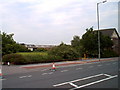
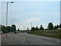
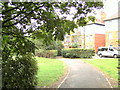
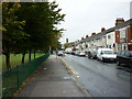
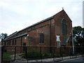
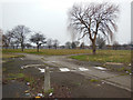
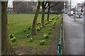
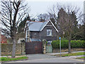
Photos of HU9 1SN


Area Information
Living in HU9 1SN offers a compact, residential experience shaped by its small cluster of homes and proximity to key services. With a population of 1,885 and a density of 324 people per square kilometre, this area is tightly knit, fostering a sense of community. The median age of 47 suggests a mature demographic, with most residents falling between 30 and 64 years old. This makes HU9 1SN a stable, low-turnover area where families and long-term residents predominate. Daily life is influenced by its location, with nearby rail and ferry links providing connectivity to larger towns and cities. The area’s character is defined by its modest scale—neither sprawling nor isolated—and its reliance on local amenities. While it lacks the vibrancy of a bustling town centre, its simplicity suits those prioritising convenience over urban energy. For buyers, HU9 1SN represents a quiet, manageable footprint with practical access to essential services, though its small size means limited housing options.
- Area Type
- Postcode
- Area Size
- Not available
- Population
- 1885
- Population Density
- 324 people/km²
The property market in HU9 1SN is defined by its limited scale and focus on owner-occupied homes. With 42% of residents owning their properties, the area leans towards a mix of private and rental markets, though the exact proportion of rental properties is not specified. The dominance of houses over flats suggests a preference for standalone properties, which may appeal to families or those seeking space. Given the small population and compact layout, the housing stock is unlikely to be extensive, meaning buyers should consider the area’s proximity to amenities and transport when evaluating its value. The lack of high-density housing also means HU9 1SN is not a hotspot for speculative investment or large-scale development. For those seeking a quiet, stable residence with traditional housing, this area offers a straightforward, if modest, option.
House Prices in HU9 1SN
No properties found in this postcode.
Energy Efficiency in HU9 1SN
The lifestyle in HU9 1SN is shaped by its proximity to retail, transport, and community hubs. Nearby shops include Asda Hull Hedon, Iceland Holderness, and Heron Southcoates, offering everyday essentials within reach. The presence of five retail outlets suggests a basic level of convenience for shopping needs. For travel, the area benefits from a ferry terminal and five railway stations, enabling easy access to Hull and surrounding regions. While there are no named parks or leisure facilities in the data, the rail and ferry links provide opportunities for recreation beyond the immediate area. The mix of retail and transport options supports a practical, low-effort lifestyle, ideal for those prioritising accessibility over extensive local amenities. The small scale of HU9 1SN means its character is defined by simplicity and functional connectivity.
Amenities
Schools
Residents of HU9 1SN have access to two primary schools: Marfleet Primary School and Marfleet Primary Academy. Both institutions cater to younger children, providing essential early education within the local area. The presence of two primary schools suggests a focus on family-friendly infrastructure, though no secondary schools are listed in the data. For parents, this means children can attend primary education locally, reducing the need for long commutes. However, families requiring secondary schooling may need to look beyond HU9 1SN, as no higher-level institutions are mentioned. The availability of two primary schools indicates a basic level of educational provision, but further research would be necessary to assess their quality or Ofsted ratings.
| Rank | School | Type | Entry gender | Ages |
|---|
Explore more schools in this area
Go to Schools tabDemographics
The community in HU9 1SN is predominantly composed of adults aged 30 to 64, reflecting a median age of 47. This age range indicates a stable population with established careers and family structures. Home ownership sits at 42%, meaning nearly half of residents own their homes, while the remaining 58% likely rent. The area is characterised by houses rather than flats, suggesting a focus on traditional, family-oriented housing. The predominant ethnic group is White, aligning with broader regional patterns. With a population density of 324 people per square kilometre, the area is neither overcrowded nor sparse, allowing for a balance between privacy and communal living. This demographic profile implies a low turnover of residents, fostering familiarity and continuity. However, the relatively low home ownership rate may indicate a reliance on rental markets or shared living arrangements.
Household Size
Accommodation Type
Tenure
Ethnic Group
Religion
Household Composition
Age
Household Deprivation
NS-SEC
Explore more demographic insights in this area
Go to Demographics tabPlanning
Planning Constraints
- Flood RiskPremium
- Ramsar Wetland SitesPremium
- Area of Outstanding Natural BeautyPremium
- Protected Nature ReservePremium
- Protected WoodlandPremium