Area Overview for HU9 1RF
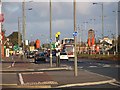
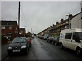
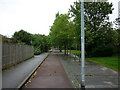
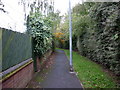
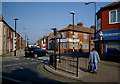
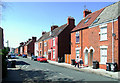
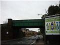
Photos of HU9 1RF

Area Information
Living in HU9 1RF means being part of a small, tightly knit residential cluster in England. With a population of 1885 and a density of 324 people per square kilometre, this area balances privacy with proximity to essential services. The postcode covers a compact network of homes, predominantly houses, which reflects a quieter, more traditional lifestyle. Residents here tend to be adults aged 30–64, with a median age of 47, suggesting a community rooted in stability and experience. Daily life is shaped by the area’s modest scale—local shops, transport links, and schools are all within practical reach. The presence of multiple rail stations, including Hull Railway Station and Cottingham Railway Station, along with the Hull Ferry Terminal, ensures connectivity to nearby cities and towns. While the area lacks natural or protected landscapes, its straightforward infrastructure and straightforward living conditions cater to those prioritising convenience over scenic surroundings. HU9 1RF is not a place for the ambitious or the adventurous, but for those seeking a settled, low-maintenance existence with access to basic amenities.
- Area Type
- Postcode
- Area Size
- Not available
- Population
- 1885
- Population Density
- 324 people/km²
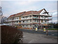
The property market in HU9 1RF is characterised by a predominance of houses, with 42% of residents owning their homes. This suggests a mix of owner-occupied properties and rental units, though the relatively low home ownership rate indicates that renting is a significant part of the local housing stock. The area’s small size and focus on single-family homes mean that property availability is limited, and buyers should consider the potential for competition in the market. The lack of high-density housing or flats implies that this is not a hotspot for investors seeking high turnover or rental yields. For those seeking a home, the emphasis on houses may appeal to families or individuals prioritising space and privacy. However, the modest population and limited development suggest that the market is unlikely to experience rapid growth or price inflation. Buyers should also note the area’s proximity to transport links, which could enhance the value of properties near rail stations or ferry terminals.
House Prices in HU9 1RF
No properties found in this postcode.
Energy Efficiency in HU9 1RF
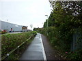
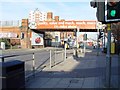
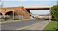
Daily life in HU9 1RF is shaped by its proximity to retail, transport, and communal spaces. The area has five retail outlets, including Lidl Wilmington, Asda Mount, and Heron Southcoates, providing access to groceries and everyday essentials. These shops cater to basic needs, though the selection is modest compared to larger towns. The Hull Ferry Terminal offers a unique mode of transport, connecting residents to nearby destinations, while rail stations like Hull Railway Station provide links to urban centres. The absence of parks or leisure facilities is notable, but the area’s compact size means that residents can reach nearby green spaces or recreational areas within a short journey. The mix of retail and transport options supports a practical lifestyle, where convenience and accessibility are prioritised over luxury or novelty. This makes HU9 1RF suitable for those who value straightforward living without the need for extensive amenities within the immediate vicinity.
Amenities
Schools
Residents of HU9 1RF have access to two primary schools: Marfleet Primary School and Marfleet Primary Academy. Both institutions cater to younger children, providing essential early education for families in the area. The presence of two primary schools within proximity suggests that parents have options for their children’s schooling, though the data does not specify Ofsted ratings or academic performance. The dual availability of primary schools may ease pressure on individual institutions, allowing for a more balanced distribution of students. For families with young children, this is a key consideration, as primary education is foundational to a child’s development. However, the absence of secondary schools or further education facilities in the immediate vicinity means that residents may need to travel to nearby towns for higher-level education. This is a practical factor for parents planning long-term schooling for their children.
| Rank | School | Type | Entry gender | Ages |
|---|
Explore more schools in this area
Go to Schools tabDemographics
The community in HU9 1RF is predominantly composed of adults aged 30–64, with a median age of 47. This suggests a mature population, likely with established careers and families. Home ownership stands at 42%, indicating that a slight majority of residents rent their properties, which may reflect the area’s character as a rental-focused zone. The accommodation type is primarily houses, which contrasts with higher-density housing found in urban centres. The predominant ethnic group is White, and no data indicates significant diversity beyond this. The population density of 324 people per square kilometre suggests a balance between residential space and communal living. While the data does not specify deprivation levels, the combination of a mature age profile and moderate home ownership may imply a community with mixed economic profiles. This demographic structure shapes a lifestyle that prioritises stability, with fewer young families or students compared to other areas.
Household Size
Accommodation Type
Tenure
Ethnic Group
Religion
Household Composition
Age
Household Deprivation
NS-SEC
Explore more demographic insights in this area
Go to Demographics tabPlanning
Planning Constraints
- Flood RiskPremium
- Ramsar Wetland SitesPremium
- Area of Outstanding Natural BeautyPremium
- Protected Nature ReservePremium
- Protected WoodlandPremium