Area Overview for HU9 1PB
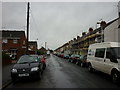
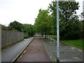
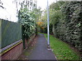
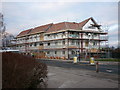
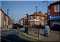
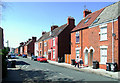
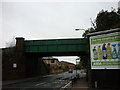
Photos of HU9 1PB


Area Information
Living in HU9 1PB means being part of a compact, residential cluster in England with a population of 1,885 people spread across 324 residents per square kilometre. This is a small, tightly knit area where daily life is shaped by proximity to essential services and a mix of local amenities. The community is predominantly composed of adults aged 30–64, with a median age of 47, suggesting a stable, established population. The area’s character is defined by its modest scale, with homes primarily in private ownership, though 42% of residents rent. Proximity to Marfleet Primary School and Marfleet Primary Academy ensures families have access to primary education. The area’s connectivity is notable, with multiple rail stations and a ferry terminal within reach, while digital infrastructure scores 100 for broadband and 85 for mobile coverage. This blend of practicality and accessibility makes HU9 1PB a viable option for those seeking a manageable, community-focused environment.
- Area Type
- Postcode
- Area Size
- Not available
- Population
- 1885
- Population Density
- 324 people/km²
The property market in HU9 1PB is characterised by a 42% home ownership rate, meaning more than half of residents rent their homes. This suggests a rental market that may cater to both long-term tenants and those seeking temporary accommodation. The accommodation type is primarily houses, indicating a lack of high-density housing such as flats or apartments. This mix of ownership and rental options could appeal to buyers looking for a home in a small, defined area, though the limited number of properties may mean competition for available stock. The presence of houses suggests a focus on family-friendly living, with potential for larger properties compared to urban areas. However, the small size of the postcode may limit the variety of properties available, requiring buyers to consider nearby areas for more options.
House Prices in HU9 1PB
No properties found in this postcode.
Energy Efficiency in HU9 1PB
The lifestyle in HU9 1PB is supported by a range of nearby amenities, including five retail outlets such as Lidl Wilmington, Asda Mount, and Heron Southcoates, offering everyday shopping needs. The proximity to Hull Ferry Terminal provides access to water-based transport, while five rail stations, including Hull Railway Station, ensure easy travel to other parts of the region. These amenities contribute to a practical, accessible lifestyle, with residents able to manage daily errands without long journeys. The area’s small size means amenities are concentrated, reducing travel time but potentially limiting diversity in offerings. The presence of multiple retail and transport options suggests a community that prioritises convenience, though the absence of leisure or cultural facilities may require residents to travel for more specialised activities.
Amenities
Schools
Residents of HU9 1PB have access to two primary schools: Marfleet Primary School and Marfleet Primary Academy. Both institutions cater to younger children, providing essential education for families in the area. The presence of two primary schools within proximity offers parents choices for their children’s early education, though no data on Ofsted ratings or academic performance is available. The availability of primary education is a key factor for families considering the area, as it reduces the need for long commutes to schools. The mix of school types ensures that parents can select between different educational approaches, though the absence of secondary schools means students will need to travel for higher education. This makes the area suitable for those prioritising primary schooling but less ideal for households requiring full educational continuity.
| Rank | School | Type | Entry gender | Ages |
|---|
Explore more schools in this area
Go to Schools tabDemographics
The population of HU9 1PB is 1,885, with a population density of 324 people per square kilometre. The median age is 47, and the majority of residents fall within the 30–64 age range, indicating a mature, stable demographic. Home ownership rates are 42%, lower than the national average, suggesting a significant proportion of residents rent. The accommodation type is predominantly houses, reflecting a residential area with a focus on family homes. The predominant ethnic group is White, and no specific data on deprivation or diversity is provided. The age profile implies a community with established careers and families, though the lower home ownership rate may indicate a mix of long-term residents and those in transient housing. The area’s density supports a close-knit environment but does not suggest overcrowding.
Household Size
Accommodation Type
Tenure
Ethnic Group
Religion
Household Composition
Age
Household Deprivation
NS-SEC
Explore more demographic insights in this area
Go to Demographics tabPlanning
Planning Constraints
- Flood RiskPremium
- Ramsar Wetland SitesPremium
- Area of Outstanding Natural BeautyPremium
- Protected Nature ReservePremium
- Protected WoodlandPremium