Area Overview for HU9 1HB
Photos of HU9 1HB
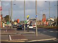
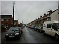
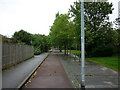
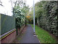
100 photos from this area
Area Information
Key information about the HU9 1HB including its size, population, and administrative classification.
- Area Type
- Postcode
- Area Size
- 4433 m²
- Population
- 1770
- Population Density
- 1680 people/km²
House Prices in HU9 1HB
28
Properties
£60,488
Average Sold Price
£17,500
Lowest Price
£96,500
Highest Price
Showing 28 properties
| Address | Type | Beds | Baths | Last Sale Price | Last Sale Date | |
|---|---|---|---|---|---|---|
| 55 Abbey Street, Kingston Upon Hull, HU9 1HB | Terraced | 2 | 1 | £58,500 | Jun 2025 | |
| 47 Abbey Street, Kingston Upon Hull, HU9 1HB | house | - | - | £50,500 | Oct 2023 | |
| 63 Abbey Street, Kingston Upon Hull, HU9 1HB | Terraced | 2 | - | £54,664 | Mar 2023 | |
| 41 Abbey Street, Kingston Upon Hull, HU9 1HB | house | 2 | 1 | £60,000 | Oct 2022 | |
| 49 Abbey Street, Kingston Upon Hull, HU9 1HB | house | - | - | £50,000 | Oct 2022 | |
| 45 Abbey Street, Kingston Upon Hull, HU9 1HB | Terraced | 2 | 1 | £76,000 | Mar 2022 | |
| 43 Abbey Street, Kingston Upon Hull, HU9 1HB | Terraced | 4 | 1 | £53,000 | Aug 2020 | |
| 39 Abbey Street, Kingston Upon Hull, HU9 1HB | Terraced | 3 | 1 | £85,000 | Jan 2020 | |
| 65 Abbey Street, Kingston Upon Hull, HU9 1HB | Terraced | 3 | 1 | £72,000 | Mar 2019 | |
| 11 Abbey Street, Kingston Upon Hull, HU9 1HB | Semi-detached | 2 | 1 | £96,500 | Oct 2018 |
Page 1 of 3
Energy Efficiency in HU9 1HB
Amenities
Schools
| Rank | School | Type | Entry gender | Ages |
|---|
Explore more schools in this area
Go to Schools tabDemographics
Household Size
One person
most common
Accommodation Type
Houses
most common
Tenure
35
majority
Ethnic Group
White
most common
Religion
N/A
most common
Household Composition
N/A
most common
Age
47
median
Adults (30-64 years)
most common
Household Deprivation
N/A
with no deprivation
NS-SEC
15
in Lower managerial occupations
Explore more demographic insights in this area
Go to Demographics tabPlanning
Planning Constraints
- Flood RiskPremium
- Ramsar Wetland SitesPremium
- Area of Outstanding Natural BeautyPremium
- Protected Nature ReservePremium
- Protected WoodlandPremium