Area Overview for HU9 1BS
Photos of HU9 1BS


Area Information
Living in HU9 1BS means inhabiting a compact, densely populated residential cluster in England. The area spans 7,491 square metres, housing 1,770 people, which equates to a population density of 1,680 people per square kilometre. This small postcode area is characterised by its tight-knit community, with homes predominantly in traditional house styles. The proximity of multiple rail stations and a ferry terminal suggests it is well-connected to nearby towns, though its size means the environment is intimate, with limited space for expansion. Daily life here is shaped by its small-scale infrastructure, where local amenities and transport links are within walking distance. The median age of 47 indicates a mature population, with a strong presence of adults aged 30–64. While the area lacks natural reserves or protected landscapes, its proximity to rail networks and retail hubs offers practical convenience. However, residents should be mindful of the high flood risk, which is a critical factor to consider for long-term living.
- Area Type
- Postcode
- Area Size
- 7491 m²
- Population
- 1770
- Population Density
- 1680 people/km²
The property market in HU9 1BS is shaped by its small size and high density. With 35% of homes owned by residents, the area leans more towards a rental market than owner-occupation. The accommodation type is primarily houses, which may reflect older or traditional housing stock. Given the limited space, property availability is constrained, and buyers should consider the proximity to rail and ferry links as a key selling point. The compact nature of the area means that properties are likely to be smaller, with limited scope for expansion. For buyers, this suggests a focus on practicality and proximity to transport rather than large-scale development. The predominance of houses may also indicate a preference for single-family living, though the high population density suggests a mix of household types.
House Prices in HU9 1BS
Showing 1 properties
| Address | Type | Beds | Baths | Last Sale Price | Last Sale Date | |
|---|---|---|---|---|---|---|
| Jordans, Motor City, Witham, Kingston Upon Hull, HU9 1BS | shop | - | - | - | - |
Energy Efficiency in HU9 1BS
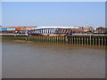
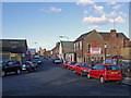
The lifestyle in HU9 1BS is defined by its proximity to essential amenities. Retail options include Lidl Wilmington, Asda Mount, and Tesco Market, offering everyday shopping within walking distance. The five nearby rail stations—Hull, New Holland, and Cottingham—provide easy access to regional destinations, while the Hull Ferry Terminal connects to other parts of the Humber Estuary. Though the area is small, its density ensures that residents have access to a range of services without needing to travel far. The presence of multiple retail outlets and transport links suggests a practical, convenience-focused lifestyle. However, the lack of parks or leisure facilities within the area means that outdoor activities may require travel to nearby locations. The compact layout fosters a community-oriented environment, where local shops and transport hubs are central to daily routines.
Amenities
Schools
| Rank | School | Type | Entry gender | Ages |
|---|
Explore more schools in this area
Go to Schools tabDemographics
The community in HU9 1BS is predominantly composed of adults aged 30–64, with a median age of 47. This suggests a mature population, likely with established careers and families. Home ownership is relatively low, at 35%, indicating that a significant portion of residents may be renting. The accommodation type is primarily houses, which aligns with the area’s compact layout and traditional housing stock. The predominant ethnic group is White, with no specific data provided on other demographics. The high population density of 1,680 people per square kilometre implies a tightly packed residential environment, which may influence the character of daily interactions and local services. While no deprivation data is available, the combination of low home ownership and high density could suggest a mix of long-term residents and those in transitional housing situations.
Household Size
Accommodation Type
Tenure
Ethnic Group
Religion
Household Composition
Age
Household Deprivation
NS-SEC
Explore more demographic insights in this area
Go to Demographics tabPlanning
Planning Constraints
- Flood RiskPremium
- Ramsar Wetland SitesPremium
- Area of Outstanding Natural BeautyPremium
- Protected Nature ReservePremium
- Protected WoodlandPremium