Area Overview for HU8 9WX
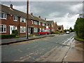
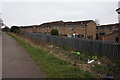
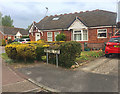
Photos of HU8 9WX


Area Information
Living in HU8 9WX means being part of a tightly knit residential cluster in England, home to 1,108 residents. This small postcode area is defined by its compact size and the presence of houses, reflecting a community that prioritises family-oriented living. The median age of 47 suggests a mature population, with adults aged 30–64 forming the largest demographic group. Daily life here is shaped by proximity to key infrastructure: three railway stations, including Hull Railway Station, and the Hull Ferry Terminal, which links residents to nearby areas. The area’s small scale means a quiet, low-density environment, though it remains well-connected to broader networks. With no significant natural constraints or protected sites, HU8 9WX offers a straightforward, practical lifestyle. Its low crime risk and excellent broadband connectivity further enhance its appeal for those seeking stability and modern convenience. For buyers, this area represents a blend of simplicity and accessibility, ideal for those who value a slower pace of life without sacrificing connectivity to urban amenities.
- Area Type
- Postcode
- Area Size
- Not available
- Population
- 1108
- Population Density
- 4699 people/km²
The property market in HU8 9WX is characterised by a high rate of home ownership (86%) and a predominance of houses. This suggests a community where long-term residency is the norm, with few rental properties available. The focus on owner-occupied homes indicates a market driven by stability rather than speculative investment. Given the small population and compact size of the area, the housing stock is likely limited to individual properties rather than larger developments. For buyers, this means a niche market with limited inventory, where properties are likely to be family homes rather than flats or apartments. The lack of planning constraints or protected sites also means fewer restrictions on property modifications or extensions. However, the small size of the area may limit opportunities for expansion or new builds. Buyers should consider the area’s practicality for those seeking a quiet, established home with strong connectivity to transport and retail amenities.
House Prices in HU8 9WX
No properties found in this postcode.
Energy Efficiency in HU8 9WX
Residents of HU8 9WX have access to a range of local amenities within practical reach. The retail landscape includes major supermarkets such as Sainsburys Ings, Asda Hull, and Morrisons Daily, ensuring everyday shopping needs are met without long journeys. The Hull Ferry Terminal provides a direct link to nearby areas, enhancing mobility for commuters and leisure travellers. Three railway stations—Hull, Cottingham, and New Holland—offer frequent services to larger urban centres, making it easy to access employment, healthcare, and cultural attractions. While the area itself is small, its proximity to transport hubs means residents can enjoy the benefits of both rural tranquillity and urban connectivity. The presence of these amenities contributes to a convenient, self-sufficient lifestyle, with minimal reliance on cars. The combination of retail, transport, and mobility options ensures daily life in HU8 9WX is practical and efficient, catering to both local and broader needs.
Amenities
Schools
| Rank | School | Type | Entry gender | Ages |
|---|
Explore more schools in this area
Go to Schools tabDemographics
The population of HU8 9WX is 1,108, with a median age of 47, indicating a community skewed towards middle-aged and older adults. The most common age range is 30–64 years, suggesting a stable, established population with strong ties to the area. Home ownership is high at 86%, with houses being the predominant accommodation type. This reflects a demographic that values long-term residency and property investment. The predominant ethnic group is White, which aligns with broader regional patterns. While specific data on deprivation is not provided, the high home ownership rate and low crime risk imply a relatively affluent and secure environment. The absence of significant diversity metrics in the data means the community’s social composition remains largely homogeneous. For residents, this translates to a predictable, low-maintenance lifestyle with minimal disruption. The area’s demographics suggest a focus on comfort and stability, with little evidence of transient populations or high turnover.
Household Size
Accommodation Type
Tenure
Ethnic Group
Religion
Household Composition
Age
Household Deprivation
NS-SEC
Explore more demographic insights in this area
Go to Demographics tabPlanning
Planning Constraints
- Flood RiskPremium
- Ramsar Wetland SitesPremium
- Area of Outstanding Natural BeautyPremium
- Protected Nature ReservePremium
- Protected WoodlandPremium