Area Overview for HU8 9EQ
Photos of HU8 9EQ

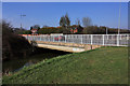
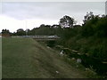
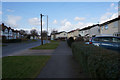


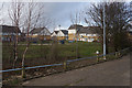
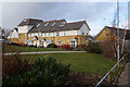

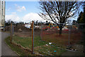
100 photos from this area
Area Information
Key information about the HU8 9EQ including its size, population, and administrative classification.
- Area Type
- Postcode
- Area Size
- 6.7 hectares
- Population
- 1969
- Population Density
- 2442 people/km²
House Prices in HU8 9EQ
100
Properties
£137,095
Average Sold Price
£54,995
Lowest Price
£280,000
Highest Price
Showing 100 properties
| Address | Type | Beds | Baths | Last Sale Price | Last Sale Date | |
|---|---|---|---|---|---|---|
| 51 Western Gailes Way, Kingston Upon Hull, HU8 9EQ | Detached | 3 | 2 | £237,500 | Sep 2025 | |
| 81 Western Gailes Way, Kingston Upon Hull, HU8 9EQ | Terraced | 4 | 3 | £215,000 | Mar 2025 | |
| 58 Western Gailes Way, Kingston Upon Hull, HU8 9EQ | Detached | 4 | - | £250,000 | Jul 2024 | |
| 36 Western Gailes Way, Kingston Upon Hull, HU8 9EQ | Semi-detached | 3 | 1 | £170,000 | Jun 2024 | |
| 56 Western Gailes Way, Kingston Upon Hull, HU8 9EQ | Detached | 3 | 1 | £240,000 | Dec 2023 | |
| 88 Western Gailes Way, Kingston Upon Hull, HU8 9EQ | Semi-detached | 3 | 1 | £165,000 | May 2023 | |
| 70 Western Gailes Way, Kingston Upon Hull, HU8 9EQ | Retail | 4 | 2 | £280,000 | Dec 2022 | |
| 23 Western Gailes Way, Kingston Upon Hull, HU8 9EQ | Semi-detached | 3 | 1 | £170,000 | May 2022 | |
| 95 Western Gailes Way, Kingston Upon Hull, HU8 9EQ | house | 3 | - | £200,000 | Feb 2022 | |
| 68 Western Gailes Way, Kingston Upon Hull, HU8 9EQ | house | 4 | - | £270,000 | Jan 2022 |
Page 1 of 10
Energy Efficiency in HU8 9EQ
Amenities
Schools
| Rank | School | Type | Entry gender | Ages |
|---|
Explore more schools in this area
Go to Schools tabDemographics
Household Size
Family (3-5 people)
most common
Accommodation Type
Houses
most common
Tenure
74
majority
Ethnic Group
White
most common
Religion
N/A
most common
Household Composition
N/A
most common
Age
47
median
Adults (30-64 years)
most common
Household Deprivation
N/A
with no deprivation
NS-SEC
27
in Lower managerial occupations
Explore more demographic insights in this area
Go to Demographics tabPlanning
Planning Constraints
- Flood RiskPremium
- Ramsar Wetland SitesPremium
- Area of Outstanding Natural BeautyPremium
- Protected Nature ReservePremium
- Protected WoodlandPremium