Area Overview for HU8 8EE
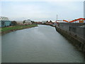
Photos of HU8 8EE


Area Information
Living in HU8 8EE offers a compact, residential experience shaped by its small population of 1,438 and proximity to key services. This postcode area, though modest in size, is anchored by a mix of local amenities and transport links that cater to daily needs. The community here is largely composed of adults aged 30-64, with a median age of 47, suggesting a settled population focused on family life or established careers. Residents benefit from a high broadband score of 100, ensuring seamless digital connectivity, while mobile coverage scores at 85, which is good for most purposes. The area’s small footprint means everything is within practical reach, from shops to transport hubs. However, crime risk is a notable concern, with a safety score of 17, indicating above-average rates. For those prioritising convenience and accessibility, HU8 8EE provides a straightforward, no-frills living environment, though buyers should weigh the security implications carefully.
- Area Type
- Postcode
- Area Size
- Not available
- Population
- 1438
- Population Density
- 2044 people/km²
The property market in HU8 8EE is characterised by a 44% home ownership rate, which is below the national average, suggesting that a significant portion of the housing stock is rented out. The accommodation type is predominantly houses, which is unusual in many densely populated areas but aligns with the area’s small, residential nature. This mix of owner-occupied and rental properties may appeal to buyers seeking a balance between stability and affordability. However, the limited size of the postcode area means the housing stock is constrained, and buyers should consider the proximity to surrounding regions for more options. The focus on houses may also mean fewer high-density developments, which could be a consideration for those prioritising space over urban convenience. The market here is likely to be niche, with properties catering to those valuing a quieter, more traditional living environment.
House Prices in HU8 8EE
No properties found in this postcode.
Energy Efficiency in HU8 8EE
The lifestyle in HU8 8EE is defined by its proximity to essential amenities within walking or short driving distance. Retail options include Asda Ferry, Tesco Chamberlain, and Morrisons Select, providing access to groceries and daily necessities. The rail network, with five stations including Hull and Cottingham, offers reliable commuting links to larger towns and cities. The Hull Ferry Terminal adds another layer of connectivity, though its usage depends on specific routes and schedules. While the area lacks expansive parks or leisure facilities, the presence of multiple retail and transport hubs ensures a functional, no-nonsense lifestyle. Residents benefit from a compact environment where essential services are clustered, reducing the need for long commutes. However, the absence of detailed information on recreational spaces or cultural amenities means buyers should consider whether this practical, service-focused lifestyle aligns with their preferences.
Amenities
Schools
Residents of HU8 8EE have access to two primary schools: Mersey Primary School and Mersey Primary Academy. Both institutions serve the local community, though Mersey Primary Academy holds a ‘good’ Ofsted rating, indicating a higher standard of education. The presence of two primary schools within the area provides families with options, though the lack of secondary schools nearby may require commuting to larger towns. The ‘good’ rating at Mersey Primary Academy suggests a reliable educational foundation for younger children, which is a key factor for families prioritising school quality. However, the absence of data on secondary education or other educational facilities means buyers should investigate further if school options beyond primary level are a concern.
| Rank | School | Type | Entry gender | Ages |
|---|
Explore more schools in this area
Go to Schools tabDemographics
The community in HU8 8EE is predominantly composed of adults aged 30-64, with a median age of 47. This suggests a population largely in their prime working years, potentially stabilised by long-term residency. Home ownership stands at 44%, meaning nearly half of residents rent their homes, which may reflect the area’s smaller scale and limited housing stock. The accommodation type is primarily houses, which is uncommon in many urban areas, hinting at a more spread-out, suburban layout. The predominant ethnic group is White, with no data provided on other demographics. The lower home ownership rate could indicate a reliance on rental properties or shared housing, which may influence the local rental market’s dynamics. While no specific deprivation data is available, the age profile and housing type suggest a community focused on stability and practicality over transient living.
Household Size
Accommodation Type
Tenure
Ethnic Group
Religion
Household Composition
Age
Household Deprivation
NS-SEC
Explore more demographic insights in this area
Go to Demographics tabPlanning
Planning Constraints
- Flood RiskPremium
- Ramsar Wetland SitesPremium
- Area of Outstanding Natural BeautyPremium
- Protected Nature ReservePremium
- Protected WoodlandPremium