Area Overview for HU8 7LA
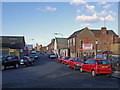
Photos of HU8 7LA


Area Information
HU8 7LA is a small residential postcode area in England, covering just 6093 square metres and home to 1770 people. With a population density of 1680 people per square kilometre, this is a compact, tightly packed community. The area’s character is defined by its proximity to retail, transport, and ferry links, making it a practical choice for those prioritising convenience. Residents benefit from five nearby retail outlets, including Asda Mount and Lidl Wilmington, as well as three rail stations—Hull, New Holland, and Cottingham—plus the Hull Ferry Terminal. The median age of 47 suggests a mature demographic, with most residents aged between 30 and 64. While the area is small, its connectivity to larger towns via rail and ferry means it balances local amenities with regional access. However, buyers should note the high flood risk and elevated crime rates, which may influence long-term considerations. For those seeking a mix of practicality and proximity to services, HU8 7LA offers a focused, if densely populated, living environment.
- Area Type
- Postcode
- Area Size
- 6093 m²
- Population
- 1770
- Population Density
- 1680 people/km²
The property market in HU8 7LA is characterised by a low home ownership rate of 35%, indicating that the majority of residents are likely to be renters rather than homeowners. The accommodation type is predominantly houses, which is notable given the area’s small size and high population density. This suggests that while the housing stock includes larger properties, the limited land area may result in constrained development opportunities. For buyers, this dynamic implies a potentially competitive market for owner-occupied homes, with fewer properties available compared to rental options. The compact nature of the area means that property values and availability are closely tied to proximity to key amenities such as rail stations and retail hubs. Prospective buyers should consider the area’s size and the practical limitations it may impose on future housing choices, particularly for families or those requiring more space.
House Prices in HU8 7LA
Showing 1 properties
| Address | Type | Beds | Baths | Last Sale Price | Last Sale Date | |
|---|---|---|---|---|---|---|
| Hard Play Area, Recreation Grounds, Dansom Lane South, Kingston Upon Hull, HU8 7LA | Leisure | - | - | - | - |
Energy Efficiency in HU8 7LA
Living in HU8 7LA offers access to a range of practical amenities within close proximity. The area is served by five retail outlets, including Asda Mount and Lidl Wilmington, providing everyday shopping convenience. Nearby rail stations—Hull, New Holland, and Cottingham—enable easy travel to larger towns, while the Hull Ferry Terminal connects residents to maritime transport options. Though the data does not specify parks or leisure facilities, the presence of multiple retail and transport hubs suggests a focus on functionality over expansive recreational spaces. The compact layout means residents can reach essential services quickly, though the high population density may impact the availability of open spaces. For those prioritising convenience and connectivity, HU8 7LA delivers a straightforward lifestyle with minimal need for long commutes or extensive travel.
Amenities
Schools
| Rank | School | Type | Entry gender | Ages |
|---|
Explore more schools in this area
Go to Schools tabDemographics
The community in HU8 7LA is predominantly composed of adults aged 30 to 64, with a median age of 47. This suggests a mature, established population, likely with strong ties to local employment or nearby urban centres. Home ownership is relatively low at 35%, indicating a significant proportion of residents are renters, which may reflect the area’s compact size and limited housing stock. The predominant accommodation type is houses, which is unusual for a densely populated postcode, hinting at a mix of larger properties and smaller homes. The White ethnic group forms the majority, though no specific data on diversity or minority representation is provided. With 1770 residents in a small area, the population density of 1680 people per square kilometre implies a tightly knit community, though this could also contribute to pressure on local services and infrastructure. The age profile and ownership figures suggest a balance between long-term residents and those seeking affordable housing in a connected location.
Household Size
Accommodation Type
Tenure
Ethnic Group
Religion
Household Composition
Age
Household Deprivation
NS-SEC
Explore more demographic insights in this area
Go to Demographics tabPlanning
Planning Constraints
- Flood RiskPremium
- Ramsar Wetland SitesPremium
- Area of Outstanding Natural BeautyPremium
- Protected Nature ReservePremium
- Protected WoodlandPremium