Area Overview for HU8 7HB
Photos of HU8 7HB


Area Information
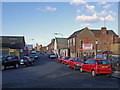
HU8 7HB is a compact postcode area in England, covering 3,562 square metres and home to 1,770 residents. Its high population density of 1,680 people per square kilometre reflects a tightly knit community, typical of smaller residential clusters. The area’s proximity to Hull and its transport links make it a practical choice for commuters, while its modest size means amenities are within walking or short driving distance. With a median age of 47 and a population skewed toward adults aged 30–64, the area is well-established, with many long-term residents. Daily life here is shaped by its mix of local shops, rail connections, and access to the nearby Hull Ferry Terminal. The presence of five retail outlets, including Tesco King and Heron Hull, ensures basic needs are met, while five railway stations provide links to the wider region. Despite its small footprint, HU8 7HB offers a balance of convenience and connectivity, though buyers should consider its safety and environmental risks before committing.
- Area Type
- Postcode
- Area Size
- 3562 m²
- Population
- 1770
- Population Density
- 1680 people/km²
The property market in HU8 7HB is largely rental-focused, with only 35% of homes owned by residents. This suggests a high proportion of tenants, which may indicate limited long-term investment opportunities for buyers. The accommodation type is predominantly houses, which are more common than flats in this area. Given the small size of the postcode and its high population density, the housing stock is likely limited, making the area competitive for buyers. The concentration of houses may appeal to those seeking traditional family homes, but the low home ownership rate implies a transient population. Prospective buyers should consider the proximity to amenities and transport links, as these are key assets in a small area. The lack of data on property prices or recent transactions means buyers must assess the market through local agents or comparative analysis with nearby postcodes.
House Prices in HU8 7HB
No properties found in this postcode.
Energy Efficiency in HU8 7HB
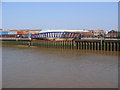
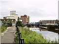
Living in HU8 7HB offers access to essential amenities within practical reach. The area includes five retail outlets, such as Tesco King and Heron Hull, ensuring daily shopping needs are met. Five railway stations, including Hull Railway Station and New Holland Railway Station, provide easy access to urban centres and regional destinations. The Hull Ferry Terminal adds a unique dimension, offering transport options to nearby areas. While the area lacks detailed data on parks or leisure facilities, its proximity to Hull suggests access to larger recreational spaces. The presence of multiple rail links and retail options contributes to a practical lifestyle, ideal for those prioritising convenience. However, the small size of the postcode means the character of the area is defined by its immediate surroundings, with limited scope for diverse leisure activities beyond the listed amenities.
Amenities
Schools
| Rank | School | Type | Entry gender | Ages |
|---|
Explore more schools in this area
Go to Schools tabDemographics
The community in HU8 7HB is predominantly composed of adults aged 30–64, with a median age of 47. This suggests a mature population, likely with established careers and families. Home ownership rates are low at 35%, indicating a rental market dominates, which may appeal to those seeking flexibility. The area is characterised by houses rather than flats, reflecting a preference for single-family living. The predominant ethnic group is White, with no specific data on other demographics provided. The high population density of 1,680 people per square kilometre means the area is compact, which can foster a close-knit community but may also impact privacy. The lack of detailed diversity data means it is unclear whether the area is ethnically varied or homogenous. For buyers, the low home ownership rate and older demographic may influence the local property market’s dynamics.
Household Size
Accommodation Type
Tenure
Ethnic Group
Religion
Household Composition
Age
Household Deprivation
NS-SEC
Explore more demographic insights in this area
Go to Demographics tabPlanning
Planning Constraints
- Flood RiskPremium
- Ramsar Wetland SitesPremium
- Area of Outstanding Natural BeautyPremium
- Protected Nature ReservePremium
- Protected WoodlandPremium