Area Overview for HU8 7EB
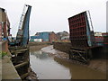
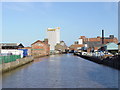
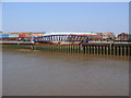
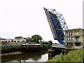
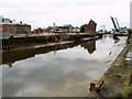
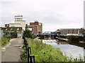
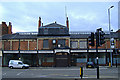
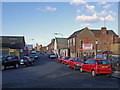
Photos of HU8 7EB


Area Information
HU8 7EB is a compact residential postcode area in England, covering 1,213 square metres and home to 1,770 residents. Its high population density of 1,680 people per square kilometre reflects a tightly knit community, where proximity to neighbours is a defining feature. This small cluster of homes sits at the intersection of practicality and connectivity, with nearby rail stations and a ferry terminal offering easy access to regional hubs. Daily life here is shaped by the area’s size — it is not sprawling but focused, with amenities and services within walking or short driving distance. The area’s appeal lies in its balance: a quiet residential base with strong links to transport networks, making it suitable for commuters or those seeking a base near urban centres. While the community is small, it is not isolated, with retail, rail, and ferry options nearby. For those prioritising convenience over space, HU8 7EB offers a self-contained lifestyle with minimal need to travel far for essentials.
- Area Type
- Postcode
- Area Size
- 1213 m²
- Population
- 1770
- Population Density
- 1680 people/km²
The property market in HU8 7EB is characterised by a low home ownership rate of 35%, suggesting that most properties are rented rather than owner-occupied. This contrasts with the accommodation type, which is predominantly houses — an unusual combination in a high-density area. The small size of the postcode means the housing stock is limited, with few new developments likely. For buyers, this implies competition for a small number of available properties, particularly houses. The area’s proximity to rail and ferry services may attract commuters or those seeking access to urban centres. However, the low home ownership rate indicates that the market is more rental-focused, which could affect long-term investment potential. Buyers should consider the limited scope for property expansion in the immediate vicinity and prioritise properties that align with the area’s existing housing stock.
House Prices in HU8 7EB
No properties found in this postcode.
Energy Efficiency in HU8 7EB
Living in HU8 7EB offers access to a range of nearby amenities that cater to daily needs. Retail options include Asda Mount, Lidl Wilmington, and Heron Southcoates, providing grocery and convenience shopping within practical reach. The area’s rail network is extensive, with five stations — Hull, New Holland, and Cottingham — ensuring easy access to regional employment hubs. The Hull Ferry Terminal adds another layer of connectivity, particularly for those needing maritime links. While the area lacks large parks or leisure facilities, the proximity to rail and retail suggests a lifestyle focused on convenience rather than sprawling amenities. The compact nature of HU8 7EB means residents can access essential services without long commutes, though those seeking expansive recreational spaces may need to travel further. The mix of retail, transport, and local services creates a functional, no-frills lifestyle.
Amenities
Schools
| Rank | School | Type | Entry gender | Ages |
|---|
Explore more schools in this area
Go to Schools tabDemographics
The population of HU8 7EB skews towards adults aged 30–64, with a median age of 47. This suggests a community of established professionals and families, rather than students or retirees. Home ownership is relatively low at 35%, indicating that a majority of residents rent their homes. The accommodation type is predominantly houses, which is uncommon in high-density areas, suggesting a mix of older properties and perhaps some newer builds. The predominant ethnic group is White, reflecting the area’s demographic profile. The high population density of 1,680 people per square kilometre means residents live closely together, which can foster a sense of community but may also impact privacy. While no specific deprivation data is provided, the low home ownership rate and older age range may indicate a population with stable employment but limited property investment.
Household Size
Accommodation Type
Tenure
Ethnic Group
Religion
Household Composition
Age
Household Deprivation
NS-SEC
Explore more demographic insights in this area
Go to Demographics tabPlanning
Planning Constraints
- Flood RiskPremium
- Ramsar Wetland SitesPremium
- Area of Outstanding Natural BeautyPremium
- Protected Nature ReservePremium
- Protected WoodlandPremium