Area Overview for HU8 0EW
Photos of HU8 0EW

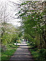
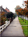
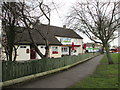


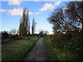
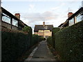
100 photos from this area
Area Information
Key information about the HU8 0EW including its size, population, and administrative classification.
- Area Type
- Postcode
- Area Size
- 2.6 hectares
- Population
- 1671
- Population Density
- 3987 people/km²
House Prices in HU8 0EW
58
Properties
£116,689
Average Sold Price
£35,000
Lowest Price
£212,500
Highest Price
Showing 58 properties
| Address | Type | Beds | Baths | Last Sale Price | Last Sale Date | |
|---|---|---|---|---|---|---|
| 174 Hathersage Road, Kingston Upon Hull, HU8 0EW | Semi-detached | 3 | 1 | £160,000 | Aug 2025 | |
| 152 Hathersage Road, Kingston Upon Hull, HU8 0EW | Semi-detached | 3 | 1 | £192,500 | Jun 2025 | |
| 136 Hathersage Road, Kingston Upon Hull, HU8 0EW | Semi-detached | 3 | 1 | £212,500 | Jun 2024 | |
| 164 Hathersage Road, Kingston Upon Hull, HU8 0EW | Semi-detached | 3 | 1 | £160,000 | Mar 2024 | |
| 153 Hathersage Road, Kingston Upon Hull, HU8 0EW | house | - | - | £180,000 | Dec 2022 | |
| 137 Hathersage Road, Kingston Upon Hull, HU8 0EW | Bungalow | - | - | £144,995 | Apr 2022 | |
| 116 Hathersage Road, Kingston Upon Hull, HU8 0EW | house | - | - | £155,000 | Dec 2021 | |
| 149 Hathersage Road, Kingston Upon Hull, HU8 0EW | house | - | - | £155,000 | Jul 2021 | |
| 184 Hathersage Road, Kingston Upon Hull, HU8 0EW | Bungalow | - | - | £96,000 | Apr 2021 | |
| 178 Hathersage Road, Kingston Upon Hull, HU8 0EW | Semi-detached | - | - | £144,000 | Apr 2021 |
Page 1 of 6
Energy Efficiency in HU8 0EW
Amenities
Schools
| Rank | School | Type | Entry gender | Ages |
|---|
Explore more schools in this area
Go to Schools tabDemographics
Household Size
Two person
most common
Accommodation Type
Houses
most common
Tenure
86
majority
Ethnic Group
White
most common
Religion
N/A
most common
Household Composition
N/A
most common
Age
47
median
Adults (30-64 years)
most common
Household Deprivation
N/A
with no deprivation
NS-SEC
30
in Lower managerial occupations
Explore more demographic insights in this area
Go to Demographics tabPlanning
Planning Constraints
- Flood RiskPremium
- Ramsar Wetland SitesPremium
- Area of Outstanding Natural BeautyPremium
- Protected Nature ReservePremium
- Protected WoodlandPremium