Area Overview for HU8 0BS
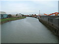
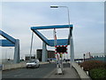
Photos of HU8 0BS


Area Information
Living in HU8 0BS means being part of a small, tightly knit residential cluster in England. With a population of 1,420 and a population density of 804 people per square kilometre, the area is compact yet functional. The community is predominantly composed of adults aged 30–64, many of whom own their homes. This demographic suggests a stable, established population with a focus on family life and long-term residency. Daily life in HU8 0BS is shaped by its proximity to key amenities, including retail outlets, rail stations, and the Hull Ferry Terminal. The area’s small size means residents are likely to know their neighbours, though the lack of major landmarks or cultural hubs may appeal to those seeking a quieter, more subdued lifestyle. The presence of Stoneferry Primary School, rated good by Ofsted, adds to the area’s appeal for families. However, the high crime risk reported in assessments is a factor to consider for prospective buyers. Overall, HU8 0BS offers a blend of practicality and simplicity, ideal for those prioritising convenience over urban vibrancy.
- Area Type
- Postcode
- Area Size
- Not available
- Population
- 1420
- Population Density
- 804 people/km²
The property market in HU8 0BS is characterised by a high rate of home ownership, with 58% of properties owner-occupied. This suggests a community where long-term residency is common, and the housing stock is largely composed of houses rather than flats or apartments. The small size of the area means the market is likely limited in scope, with a focus on individual properties rather than larger developments. For buyers, this implies a potentially stable market with fewer speculative investments. However, the limited data on property types or prices means it is unclear whether the area is more attractive to first-time buyers or investors. The predominance of houses may appeal to those seeking space and privacy, but the small population and lack of nearby urban centres could limit options for those requiring larger homes or proximity to commercial areas. Prospective buyers should consider the area’s compact nature when evaluating its suitability for their needs.
House Prices in HU8 0BS
No properties found in this postcode.
Energy Efficiency in HU8 0BS
The lifestyle in HU8 0BS is shaped by its proximity to a range of practical amenities. Residents have access to five retail outlets, including Asda Ferry, Morrisons Select, and Aldi Bransholme, ensuring everyday shopping needs are met. The area’s rail stations—Hull, Cottingham, and New Holland—provide regular connections to nearby towns and cities, while the Hull Ferry Terminal offers an alternative route for travel or leisure. Though the area is small, these amenities contribute to a functional daily life, with shops, transport, and ferry services all within easy reach. The absence of larger leisure facilities or cultural hubs suggests a focus on practicality over recreation, though the presence of a primary school adds to the community’s family-friendly character. For those prioritising convenience and accessibility, HU8 0BS offers a straightforward, no-frills lifestyle.
Amenities
Schools
The nearest school to HU8 0BS is Stoneferry Primary School, which serves the area’s primary education needs. The school is explicitly listed as a primary institution with an Ofsted rating of ‘good’. This rating indicates that the school meets or exceeds national standards in teaching quality, pupil outcomes, and overall performance. The presence of a single primary school suggests that families in HU8 0BS may have limited options for secondary education, requiring them to travel to nearby areas. However, the ‘good’ rating provides reassurance about the quality of early education available. The school’s proximity to the area makes it a practical choice for local families, though the absence of additional schools or specialist provision may be a consideration for those requiring more diverse educational options.
| Rank | School | Type | Entry gender | Ages |
|---|
Explore more schools in this area
Go to Schools tabDemographics
The community in HU8 0BS is defined by its age profile and home ownership rates. The median age is 47, with the majority of residents falling within the 30–64 age range. This suggests a population skewed towards middle-aged adults, likely with established careers and families. Home ownership stands at 58%, indicating a strong presence of owner-occupied properties. The accommodation type is predominantly houses, which aligns with the area’s small-scale residential character. The predominant ethnic group is White, though no specific data on diversity or deprivation is provided. The age demographic implies a community with a focus on stability, where residents may have long-term ties to the area. However, the lack of data on socioeconomic factors means it is unclear how this translates to quality of life. The absence of younger or older demographics may also affect local services and amenities, though the presence of a primary school suggests some provision for families.
Household Size
Accommodation Type
Tenure
Ethnic Group
Religion
Household Composition
Age
Household Deprivation
NS-SEC
Explore more demographic insights in this area
Go to Demographics tabPlanning
Planning Constraints
- Flood RiskPremium
- Ramsar Wetland SitesPremium
- Area of Outstanding Natural BeautyPremium
- Protected Nature ReservePremium
- Protected WoodlandPremium