Area Overview for HU8 0AA
Photos of HU8 0AA
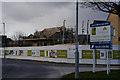
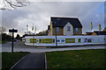

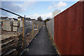
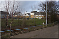
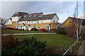
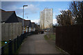
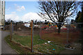
100 photos from this area
Area Information
Key information about the HU8 0AA including its size, population, and administrative classification.
- Area Type
- Postcode
- Area Size
- 1.7 hectares
- Population
- 1857
- Population Density
- 3554 people/km²
House Prices in HU8 0AA
84
Properties
£98,523
Average Sold Price
£8,000
Lowest Price
£171,995
Highest Price
Showing 84 properties
| Address | Type | Beds | Baths | Last Sale Price | Last Sale Date | |
|---|---|---|---|---|---|---|
| 50 Perivale Close, Kingston Upon Hull, HU8 0AA | Semi-detached | 2 | 2 | £165,500 | Sep 2024 | |
| 40 Perivale Close, Kingston Upon Hull, HU8 0AA | house | - | - | £125,000 | Mar 2021 | |
| 35 Perivale Close, Kingston Upon Hull, HU8 0AA | house | - | - | £157,500 | Aug 2016 | |
| 46 Perivale Close, Kingston Upon Hull, HU8 0AA | house | - | - | £161,500 | Jun 2016 | |
| 44 Perivale Close, Kingston Upon Hull, HU8 0AA | house | - | - | £161,500 | May 2016 | |
| 42 Perivale Close, Kingston Upon Hull, HU8 0AA | house | - | - | £124,950 | May 2016 | |
| 52 Perivale Close, Kingston Upon Hull, HU8 0AA | house | - | - | £171,995 | May 2016 | |
| 54 Perivale Close, Kingston Upon Hull, HU8 0AA | house | - | - | £169,995 | Apr 2016 | |
| 28 Perivale Close, Kingston Upon Hull, HU8 0AA | house | - | - | £68,000 | Oct 2009 | |
| 4 Perivale Close, Kingston Upon Hull, HU8 0AA | house | - | - | £65,000 | Apr 2009 |
Page 1 of 9
Energy Efficiency in HU8 0AA
Amenities
Schools
| Rank | School | Type | Entry gender | Ages |
|---|
Explore more schools in this area
Go to Schools tabDemographics
Household Size
One person
most common
Accommodation Type
Houses
most common
Tenure
45
majority
Ethnic Group
White
most common
Religion
N/A
most common
Household Composition
N/A
most common
Age
47
median
Adults (30-64 years)
most common
Household Deprivation
N/A
with no deprivation
NS-SEC
23
in Lower managerial occupations
Explore more demographic insights in this area
Go to Demographics tabPlanning
Planning Constraints
- Flood RiskPremium
- Ramsar Wetland SitesPremium
- Area of Outstanding Natural BeautyPremium
- Protected Nature ReservePremium
- Protected WoodlandPremium