Area Overview for HU7 4QN
Photos of HU7 4QN
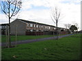


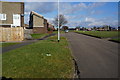
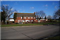

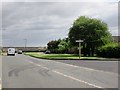

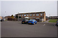
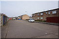
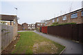
100 photos from this area
Area Information
Key information about the HU7 4QN including its size, population, and administrative classification.
- Area Type
- Postcode
- Area Size
- 2.7 hectares
- Population
- 1275
- Population Density
- 3543 people/km²
House Prices in HU7 4QN
62
Properties
£67,441
Average Sold Price
£10,260
Lowest Price
£185,000
Highest Price
Showing 62 properties
| Address | Type | Beds | Baths | Last Sale Price | Last Sale Date | |
|---|---|---|---|---|---|---|
| 294 Stroud Crescent East, Kingston Upon Hull, HU7 4QN | Terraced | 3 | 1 | £99,950 | Jul 2025 | |
| 402 Stroud Crescent East, Kingston Upon Hull, HU7 4QN | Detached | 2 | 1 | £52,000 | Jan 2025 | |
| 292 Stroud Crescent East, Kingston Upon Hull, HU7 4QN | Terraced | 3 | 1 | £68,000 | Aug 2024 | |
| 312 Stroud Crescent East, Kingston Upon Hull, HU7 4QN | house | - | - | £85,000 | Jan 2023 | |
| 326 Stroud Crescent East, Kingston Upon Hull, HU7 4QN | Terraced | 5 | - | £70,000 | Aug 2021 | |
| 296 Stroud Crescent East, Kingston Upon Hull, HU7 4QN | house | 3 | - | £60,000 | Mar 2016 | |
| 324 Stroud Crescent East, Kingston Upon Hull, HU7 4QN | Terraced | - | - | £185,000 | Apr 2015 | |
| 398 Stroud Crescent East, Kingston Upon Hull, HU7 4QN | house | - | - | £63,000 | Jul 2013 | |
| 382 Stroud Crescent East, Kingston Upon Hull, HU7 4QN | house | 3 | - | £65,000 | Jun 2010 | |
| 370 Stroud Crescent East, Kingston Upon Hull, HU7 4QN | house | - | - | £65,000 | Nov 2009 |
Page 1 of 7
Energy Efficiency in HU7 4QN
Amenities
Schools
| Rank | School | Type | Entry gender | Ages |
|---|
Explore more schools in this area
Go to Schools tabDemographics
Household Size
Two person
most common
Accommodation Type
Houses
most common
Tenure
43
majority
Ethnic Group
White
most common
Religion
N/A
most common
Household Composition
N/A
most common
Age
47
median
Adults (30-64 years)
most common
Household Deprivation
N/A
with no deprivation
NS-SEC
11
in Lower managerial occupations
Explore more demographic insights in this area
Go to Demographics tabPlanning
Planning Constraints
- Flood RiskPremium
- Ramsar Wetland SitesPremium
- Area of Outstanding Natural BeautyPremium
- Protected Nature ReservePremium
- Protected WoodlandPremium