Area Overview for HU7 4ED
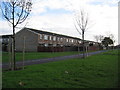
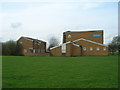
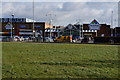
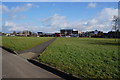
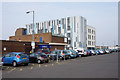
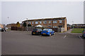
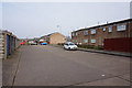
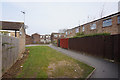
Photos of HU7 4ED
Area Information
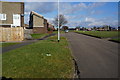
Living in HU7 4ED means being part of a small, tightly knit residential cluster in England, home to 1459 people. This area is characterised by its modest scale and proximity to practical amenities, making it a compact choice for those seeking a balance between convenience and quiet living. The community is predominantly composed of adults aged 30–64, with a median age of 47, suggesting a mature, stable population. Daily life here is shaped by the local infrastructure, including nearby rail links and retail options. While the area does not boast sprawling landscapes or large public spaces, its accessibility to transport networks like Hull Railway Station and the Hull Ferry Terminal offers flexibility for commuters and travelers. The presence of five retail outlets, including Iceland Bransholme and Farmfoods Bransholme, ensures basic shopping needs are met within reach. For those prioritising a low-maintenance lifestyle, HU7 4ED’s small size and limited development mean it retains a distinct local identity, free from the pressures of larger urban centres.
- Area Type
- Postcode
- Area Size
- Not available
- Population
- 1459
- Population Density
- 4946 people/km²
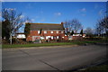
The property market in HU7 4ED is defined by its small size and limited housing stock. With 30% of residents owning their homes, the area is not a major hub for owner-occupation, suggesting a higher proportion of rental properties. The accommodation type is predominantly houses, which contrasts with areas where flats or apartments dominate. This means the housing stock is likely to be older, with more traditional layouts and potentially smaller plots of land. For buyers, the small scale of the area means competition for properties is likely to be minimal, but the limited number of homes may restrict options for those seeking specific features. The lack of high-density development also means the area is unlikely to experience rapid price fluctuations or speculative investment. Those considering HU7 4ED should view it as a niche market, where properties are more about location and local convenience than broader capital growth potential.
House Prices in HU7 4ED
No properties found in this postcode.
Energy Efficiency in HU7 4ED
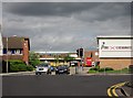
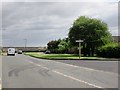
Life in HU7 4ED is shaped by its proximity to essential amenities, including five retail outlets such as Heron Goodhart, Iceland Bransholme, and Farmfoods Bransholme. These stores provide access to groceries, household goods, and everyday necessities, reducing the need for long trips. The area’s rail network, with stations like Hull and Cottingham, connects residents to nearby towns and cities, facilitating commuting or weekend excursions. The Hull Ferry Terminal offers an additional layer of mobility, linking the area to maritime routes. While the area lacks expansive parks or leisure facilities, its compact layout ensures that amenities are within practical reach. The presence of multiple retail and transport options contributes to a functional, no-frills lifestyle, ideal for those who value convenience over large-scale entertainment or recreational spaces.
Amenities
Schools
| Rank | School | Type | Entry gender | Ages |
|---|
Explore more schools in this area
Go to Schools tabDemographics
The community in HU7 4ED is largely composed of adults aged 30–64, with a median age of 47. This suggests a population that is settled, with fewer young families or elderly residents compared to other areas. Home ownership here is relatively low at 30%, indicating that a significant portion of the housing stock is rented. The predominant accommodation type is houses, which aligns with the area’s small, residential character. The demographic data also shows that the majority of residents identify as White, with no specific information provided on other ethnic groups. This composition contributes to a community that may feel familiar to those accustomed to traditional, low-density housing. The lower home ownership rate could imply a transient population or a reliance on rental properties, which may influence the area’s social dynamics and long-term stability.
Household Size
Accommodation Type
Tenure
Ethnic Group
Religion
Household Composition
Age
Household Deprivation
NS-SEC
Explore more demographic insights in this area
Go to Demographics tabPlanning
Planning Constraints
- Flood RiskPremium
- Ramsar Wetland SitesPremium
- Area of Outstanding Natural BeautyPremium
- Protected Nature ReservePremium
- Protected WoodlandPremium