Area Overview for HU7 4BW
Photos of HU7 4BW
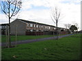
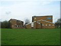
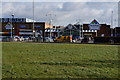
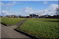
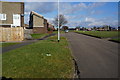
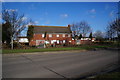
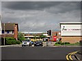
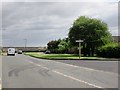
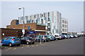
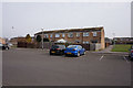
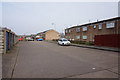
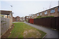
100 photos from this area
Area Information
Key information about the HU7 4BW including its size, population, and administrative classification.
- Area Type
- Postcode
- Area Size
- 1.7 hectares
- Population
- 1208
- Population Density
- 9750 people/km²
House Prices in HU7 4BW
67
Properties
£85,756
Average Sold Price
£26,950
Lowest Price
£130,000
Highest Price
Showing 67 properties
| Address | Type | Beds | Baths | Last Sale Price | Last Sale Date | |
|---|---|---|---|---|---|---|
| 457 Newtondale, Kingston Upon Hull, HU7 4BW | Terraced | 3 | 1 | £120,000 | Dec 2022 | |
| 393 Newtondale, Kingston Upon Hull, HU7 4BW | Terraced | 3 | 1 | £115,000 | Dec 2022 | |
| 431 Newtondale, Kingston Upon Hull, HU7 4BW | house | - | - | £130,000 | Mar 2021 | |
| 455 Newtondale, Kingston Upon Hull, HU7 4BW | Terraced | 3 | 1 | £119,000 | Sep 2020 | |
| 461 Newtondale, Kingston Upon Hull, HU7 4BW | house | - | - | £115,000 | Sep 2020 | |
| 413 Newtondale, Kingston Upon Hull, HU7 4BW | Terraced | 3 | 1 | £119,950 | Aug 2020 | |
| 469 Newtondale, Kingston Upon Hull, HU7 4BW | Terraced | 3 | - | £129,995 | May 2020 | |
| 449 Newtondale, Kingston Upon Hull, HU7 4BW | Terraced | 3 | - | £100,000 | Jul 2016 | |
| 471 Newtondale, Kingston Upon Hull, HU7 4BW | house | 3 | 1 | £60,000 | Dec 2015 | |
| 441 Newtondale, Kingston Upon Hull, HU7 4BW | Terraced | 3 | - | £95,000 | May 2015 |
Page 1 of 7
Energy Efficiency in HU7 4BW
Amenities
Schools
| Rank | School | Type | Entry gender | Ages |
|---|
Explore more schools in this area
Go to Schools tabDemographics
Household Size
Family (3-5 people)
most common
Accommodation Type
Houses
most common
Tenure
82
majority
Ethnic Group
White
most common
Religion
N/A
most common
Household Composition
N/A
most common
Age
47
median
Adults (30-64 years)
most common
Household Deprivation
N/A
with no deprivation
NS-SEC
20
in Lower managerial occupations
Explore more demographic insights in this area
Go to Demographics tabPlanning
Planning Constraints
- Flood RiskPremium
- Ramsar Wetland SitesPremium
- Area of Outstanding Natural BeautyPremium
- Protected Nature ReservePremium
- Protected WoodlandPremium