Area Overview for HU7 3FD
Photos of HU7 3FD


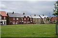
56 photos from this area
Area Information
Key information about the HU7 3FD including its size, population, and administrative classification.
- Area Type
- Postcode
- Area Size
- 4347 m²
- Population
- 2537
- Population Density
- 4947 people/km²
House Prices in HU7 3FD
17
Properties
£154,372
Average Sold Price
£106,000
Lowest Price
£194,995
Highest Price
Showing 17 properties
| Address | Type | Beds | Baths | Last Sale Price | Last Sale Date | |
|---|---|---|---|---|---|---|
| 130 Grosvenor Road, Kingston Upon Hull, HU7 3FD | Flat | - | - | £106,000 | Feb 2025 | |
| 120 Grosvenor Road, Kingston Upon Hull, HU7 3FD | Terraced | 3 | 1 | £180,000 | Dec 2024 | |
| 138 Grosvenor Road, Kingston Upon Hull, HU7 3FD | Terraced | 3 | 1 | £167,995 | May 2024 | |
| 146 Grosvenor Road, Kingston Upon Hull, HU7 3FD | Flat | - | - | £107,000 | Mar 2024 | |
| 144 Grosvenor Road, Kingston Upon Hull, HU7 3FD | Terraced | 2 | 1 | £155,000 | Feb 2024 | |
| 150 Grosvenor Road, Kingston Upon Hull, HU7 3FD | Terraced | 3 | 2 | £155,000 | Dec 2023 | |
| 126 Grosvenor Road, Kingston Upon Hull, HU7 3FD | Retail | 3 | 1 | £190,000 | Sep 2022 | |
| 122 Grosvenor Road, Kingston Upon Hull, HU7 3FD | house | - | - | £168,995 | Oct 2017 | |
| 124 Grosvenor Road, Kingston Upon Hull, HU7 3FD | Terraced | 3 | 1 | £167,995 | Sep 2017 | |
| 128 Grosvenor Road, Kingston Upon Hull, HU7 3FD | house | - | - | £190,000 | Sep 2017 |
Page 1 of 2
Energy Efficiency in HU7 3FD
Amenities
Schools
| Rank | School | Type | Entry gender | Ages |
|---|
Explore more schools in this area
Go to Schools tabDemographics
Household Size
Family (3-5 people)
most common
Accommodation Type
Houses
most common
Tenure
89
majority
Ethnic Group
White
most common
Religion
N/A
most common
Household Composition
N/A
most common
Age
22
median
Adults (30-64 years)
most common
Household Deprivation
N/A
with no deprivation
NS-SEC
42
in Lower managerial occupations
Explore more demographic insights in this area
Go to Demographics tabPlanning
Planning Constraints
- Flood RiskPremium
- Ramsar Wetland SitesPremium
- Area of Outstanding Natural BeautyPremium
- Protected Nature ReservePremium
- Protected WoodlandPremium