Area Overview for HU6 8QH
Photos of HU6 8QH
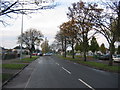
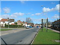
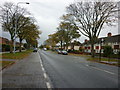
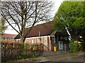
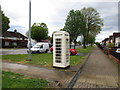
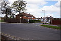

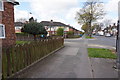
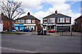
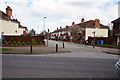
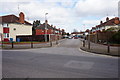
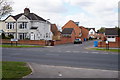
100 photos from this area
Area Information
Key information about the HU6 8QH including its size, population, and administrative classification.
- Area Type
- Postcode
- Area Size
- 7707 m²
- Population
- 1984
- Population Density
- 5942 people/km²
House Prices in HU6 8QH
37
Properties
£128,317
Average Sold Price
£52,000
Lowest Price
£250,000
Highest Price
Showing 37 properties
| Address | Type | Beds | Baths | Last Sale Price | Last Sale Date | |
|---|---|---|---|---|---|---|
| 2 Redhill Park, Kingston Upon Hull, HU6 8QH | Detached | 4 | 2 | £250,000 | May 2024 | |
| 28 Redhill Park, Kingston Upon Hull, HU6 8QH | Flat | 2 | 2 | £82,000 | Feb 2024 | |
| 38 Redhill Park, Kingston Upon Hull, HU6 8QH | Flat | 2 | 1 | £84,000 | Feb 2023 | |
| 18 Redhill Park, Kingston Upon Hull, HU6 8QH | Semi-detached | 2 | 2 | £130,000 | Jul 2022 | |
| 8 Redhill Park, Kingston Upon Hull, HU6 8QH | Semi-detached | 4 | 3 | £160,000 | Jun 2022 | |
| 21 Redhill Park, Kingston Upon Hull, HU6 8QH | Terraced | 4 | 2 | £180,000 | Jun 2022 | |
| 1 Redhill Park, Kingston Upon Hull, HU6 8QH | Semi-detached | 3 | 3 | £126,000 | Feb 2021 | |
| 19 Redhill Park, Kingston Upon Hull, HU6 8QH | Terraced | 4 | 2 | £136,500 | Jan 2020 | |
| 40 Redhill Park, Kingston Upon Hull, HU6 8QH | Flat | - | - | £73,250 | May 2019 | |
| 20 Redhill Park, Kingston Upon Hull, HU6 8QH | Terraced | 2 | 1 | £85,500 | May 2019 |
Page 1 of 4
Energy Efficiency in HU6 8QH
Amenities
Schools
| Rank | School | Type | Entry gender | Ages |
|---|
Explore more schools in this area
Go to Schools tabDemographics
Household Size
Family (3-5 people)
most common
Accommodation Type
Houses
most common
Tenure
50
majority
Ethnic Group
White
most common
Religion
N/A
most common
Household Composition
N/A
most common
Age
47
median
Adults (30-64 years)
most common
Household Deprivation
N/A
with no deprivation
NS-SEC
23
in Lower managerial occupations
Explore more demographic insights in this area
Go to Demographics tabPlanning
Planning Constraints
- Flood RiskPremium
- Ramsar Wetland SitesPremium
- Area of Outstanding Natural BeautyPremium
- Protected Nature ReservePremium
- Protected WoodlandPremium