Area Overview for HU6 8NW
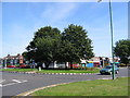
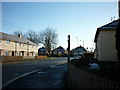
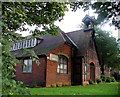
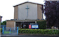
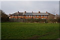
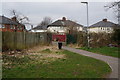
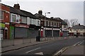
Photos of HU6 8NW

Area Information
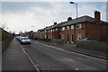
Living in HU6 8NW offers a compact, residential experience shaped by its small cluster of homes and proximity to key services. With a population of 1,984, the area is a tight-knit community where daily life revolves around local amenities and straightforward connectivity. The postcode covers a limited geographical footprint, making it ideal for those seeking a quiet, manageable environment. Residents benefit from nearby rail links, including Cottingham, Hull, and Hessle stations, which provide access to regional hubs. The area’s appeal lies in its balance of practicality and accessibility, with a ferry terminal at Hull offering transport options to nearby destinations. While the housing stock is predominantly houses, the 50% home ownership rate suggests a mix of owner-occupied and rental properties. Families and adults in their prime working years (30-64) form the core demographic, reflecting a mature, stable community. The presence of Hall Road Primary School and Hall Road Academy ensures educational needs are met, though the area’s small size means it is best suited for those prioritising convenience over expansive space.
- Area Type
- Postcode
- Area Size
- Not available
- Population
- 1984
- Population Density
- 5942 people/km²
The property market in HU6 8NW is characterised by a 50% home ownership rate, suggesting a balanced split between owner-occupied and rental properties. The area’s housing stock is predominantly houses, which are more common than flats or apartments. This reflects a residential focus suited to families or individuals seeking traditional living spaces. Given the small size of the postcode area, the property market is likely limited in scope, with limited scope for large-scale development. Buyers should consider that the area’s compact nature means property choices are constrained to the immediate vicinity. The house-dominated stock may appeal to those prioritising space and privacy over high-density living. However, the 50% ownership rate also indicates a rental market component, which could influence availability and competition for properties. Prospective buyers should view the area as a niche option, best suited for those valuing a quiet, established residential environment over broader urban amenities.
House Prices in HU6 8NW
No properties found in this postcode.
Energy Efficiency in HU6 8NW
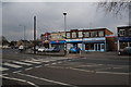
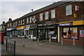
The lifestyle in HU6 8NW is shaped by its proximity to practical amenities. Retail options include Morrisons Daily, Tesco Hull, and Heron Endike, providing everyday shopping needs within reach. The five nearby rail stations—Cottingham, Hull, Hessle, and two others—ensure easy access to employment, leisure, and regional travel. The Hull Ferry Terminal adds versatility, connecting residents to other areas via water. While the area’s small size means it lacks sprawling parks or large leisure facilities, its compact nature ensures amenities are close to homes. The mix of retail and transport options supports a convenient, low-effort lifestyle. However, those seeking expansive recreational spaces may need to venture beyond the immediate vicinity. The presence of schools and shops within walking or short driving distance reinforces the area’s appeal for those prioritising ease of access over sprawling urban amenities.
Amenities
Schools
Residents of HU6 8NW have access to two key educational institutions. Hall Road Primary School provides foundational education for younger children, while Hall Road Academy, an academy with an Ofsted rating of ‘good’, caters to secondary education. The combination of a primary school and a rated academy ensures a continuum of education for families within the area. However, the absence of additional schools means families may need to travel beyond the immediate vicinity for specialist or higher education options. The presence of a ‘good’-rated academy suggests a satisfactory standard of secondary education, though it does not guarantee exceptional performance. For parents prioritising proximity to schools, this mix of institutions offers a practical solution, though the area’s small size limits the range of educational choices.
| Rank | School | Type | Entry gender | Ages |
|---|
Explore more schools in this area
Go to Schools tabDemographics
The community in HU6 8NW is defined by its median age of 47, with the majority of residents falling within the 30-64 age range. This suggests a population of working-age adults and families, rather than a younger or elderly demographic. Home ownership stands at 50%, indicating a mix of owner-occupied and rental properties. The predominant accommodation type is houses, which aligns with the area’s residential character. The predominant ethnic group is White, reflecting a homogenous demographic profile. While no specific data on deprivation is provided, the age and ownership statistics imply a stable, middle-aged population with established roots. The absence of detailed diversity metrics means the community’s composition remains largely unvaried. For those considering relocation, this profile suggests a quiet, settled environment where residents are likely to be long-term residents rather than transient populations.
Household Size
Accommodation Type
Tenure
Ethnic Group
Religion
Household Composition
Age
Household Deprivation
NS-SEC
Explore more demographic insights in this area
Go to Demographics tabPlanning
Planning Constraints
- Flood RiskPremium
- Ramsar Wetland SitesPremium
- Area of Outstanding Natural BeautyPremium
- Protected Nature ReservePremium
- Protected WoodlandPremium