Area Overview for HU6 8NS
Photos of HU6 8NS
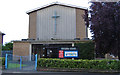
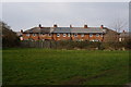
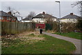
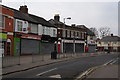
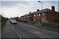
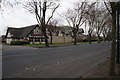
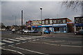
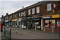
100 photos from this area
Area Information
Key information about the HU6 8NS including its size, population, and administrative classification.
- Area Type
- Postcode
- Area Size
- 2805 m²
- Population
- 1737
- Population Density
- 8620 people/km²
House Prices in HU6 8NS
11
Properties
£17,000
Average Sold Price
£17,000
Lowest Price
£17,000
Highest Price
Showing 11 properties
| Address | Type | Beds | Baths | Last Sale Price | Last Sale Date | |
|---|---|---|---|---|---|---|
| 102 The Quadrant, Kingston Upon Hull, HU6 8NS | Flat | 1 | 2 | £17,000 | Apr 2005 | |
| Flat Above, 100 The Quadrant, Kingston Upon Hull, HU6 8NS | Terraced | 1 | 2 | - | - | |
| Flat At, 96 The Quadrant, Kingston Upon Hull, HU6 8NS | Flat | 4 | 4 | - | - | |
| Re Run Eternal Benefits, 104 The Quadrant, Kingston Upon Hull, HU6 8NS | shop | - | - | - | - | |
| Flat, 102 The Quadrant, Kingston Upon Hull, HU6 8NS | Unknown | - | - | - | - | |
| Historic, 100 The Quadrant, Kingston Upon Hull, HU6 8NS | Unknown | - | - | - | - | |
| First Floor Flat, 90 The Quadrant, Kingston Upon Hull, HU6 8NS | Flat | - | - | - | - | |
| Flat, 92 The Quadrant, Kingston Upon Hull, HU6 8NS | Flat | - | - | - | - | |
| Flat, 94 The Quadrant, Kingston Upon Hull, HU6 8NS | Maisonette | - | - | - | - | |
| Flat, 98 The Quadrant, Kingston Upon Hull, HU6 8NS | Flat | - | - | - | - |
Page 1 of 2
Energy Efficiency in HU6 8NS
Amenities
Schools
| Rank | School | Type | Entry gender | Ages |
|---|
Explore more schools in this area
Go to Schools tabDemographics
Household Size
Family (3-5 people)
most common
Accommodation Type
Houses
most common
Tenure
36
majority
Ethnic Group
White
most common
Religion
N/A
most common
Household Composition
N/A
most common
Age
47
median
Adults (30-64 years)
most common
Household Deprivation
N/A
with no deprivation
NS-SEC
12
in Lower managerial occupations
Explore more demographic insights in this area
Go to Demographics tabPlanning
Planning Constraints
- Flood RiskPremium
- Ramsar Wetland SitesPremium
- Area of Outstanding Natural BeautyPremium
- Protected Nature ReservePremium
- Protected WoodlandPremium