Area Overview for HU5 5XP
Photos of HU5 5XP
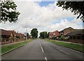
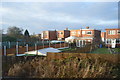
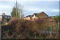
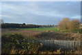
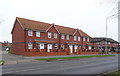
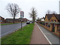
100 photos from this area
Area Information
Key information about the HU5 5XP including its size, population, and administrative classification.
- Area Type
- Postcode
- Area Size
- 1.9 hectares
- Population
- 1213
- Population Density
- 6632 people/km²
House Prices in HU5 5XP
69
Properties
£84,827
Average Sold Price
£22,000
Lowest Price
£141,000
Highest Price
Showing 69 properties
| Address | Type | Beds | Baths | Last Sale Price | Last Sale Date | |
|---|---|---|---|---|---|---|
| 165 Bristol Road, Kingston Upon Hull, HU5 5XP | Terraced | 2 | 1 | £92,000 | Nov 2025 | |
| 211 Bristol Road, Kingston Upon Hull, HU5 5XP | Terraced | 2 | 1 | £118,000 | Jun 2025 | |
| 234 Bristol Road, Kingston Upon Hull, HU5 5XP | Terraced | 3 | 1 | £135,000 | Feb 2024 | |
| 214 Bristol Road, Kingston Upon Hull, HU5 5XP | Terraced | 2 | 2 | £115,000 | Jan 2024 | |
| 200 Bristol Road, Kingston Upon Hull, HU5 5XP | Terraced | 2 | 1 | £135,000 | Nov 2023 | |
| 197 Bristol Road, Kingston Upon Hull, HU5 5XP | Terraced | 2 | 1 | £109,000 | Nov 2023 | |
| 207 Bristol Road, Kingston Upon Hull, HU5 5XP | Terraced | 2 | 1 | £115,000 | Sep 2023 | |
| 153 Bristol Road, Kingston Upon Hull, HU5 5XP | Terraced | 2 | 1 | £141,000 | Sep 2022 | |
| 248 Bristol Road, Kingston Upon Hull, HU5 5XP | Terraced | 2 | 1 | £117,000 | May 2022 | |
| 238 Bristol Road, Kingston Upon Hull, HU5 5XP | Terraced | 2 | 1 | £113,000 | Jan 2022 |
Page 1 of 7
Energy Efficiency in HU5 5XP
Amenities
Schools
| Rank | School | Type | Entry gender | Ages |
|---|
Explore more schools in this area
Go to Schools tabDemographics
Household Size
Two person
most common
Accommodation Type
Houses
most common
Tenure
56
majority
Ethnic Group
White
most common
Religion
N/A
most common
Household Composition
N/A
most common
Age
47
median
Adults (30-64 years)
most common
Household Deprivation
N/A
with no deprivation
NS-SEC
21
in Lower managerial occupations
Explore more demographic insights in this area
Go to Demographics tabPlanning
Planning Constraints
- Flood RiskPremium
- Ramsar Wetland SitesPremium
- Area of Outstanding Natural BeautyPremium
- Protected Nature ReservePremium
- Protected WoodlandPremium