Area Overview for HU5 5TE
Photos of HU5 5TE
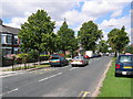
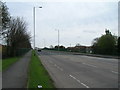
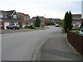
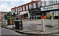
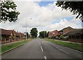
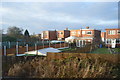
100 photos from this area
Area Information
Key information about the HU5 5TE including its size, population, and administrative classification.
- Area Type
- Postcode
- Area Size
- 1.5 hectares
- Population
- 1403
- Population Density
- 4904 people/km²
House Prices in HU5 5TE
47
Properties
£107,167
Average Sold Price
£44,000
Lowest Price
£160,000
Highest Price
Showing 47 properties
| Address | Type | Beds | Baths | Last Sale Price | Last Sale Date | |
|---|---|---|---|---|---|---|
| 82 Dayton Road, Kingston Upon Hull, HU5 5TE | Terraced | 3 | 1 | £160,000 | Oct 2025 | |
| 90 Dayton Road, Kingston Upon Hull, HU5 5TE | Terraced | 3 | 1 | £118,000 | Aug 2024 | |
| 78 Dayton Road, Kingston Upon Hull, HU5 5TE | Terraced | 3 | 1 | £155,000 | Aug 2024 | |
| 91 Dayton Road, Kingston Upon Hull, HU5 5TE | Retail | 3 | 1 | £132,000 | Oct 2022 | |
| 86 Dayton Road, Kingston Upon Hull, HU5 5TE | Terraced | 3 | 1 | £140,000 | Aug 2018 | |
| 96 Dayton Road, Kingston Upon Hull, HU5 5TE | house | - | - | £102,500 | Aug 2017 | |
| 72 Dayton Road, Kingston Upon Hull, HU5 5TE | house | - | - | £122,500 | Mar 2017 | |
| 101 Dayton Road, Kingston Upon Hull, HU5 5TE | Terraced | 3 | - | £127,000 | Nov 2015 | |
| 88 Dayton Road, Kingston Upon Hull, HU5 5TE | Terraced | 3 | 1 | £114,000 | Jun 2015 | |
| 130 Dayton Road, Kingston Upon Hull, HU5 5TE | Flat | - | - | £64,000 | May 2015 |
Page 1 of 5
Energy Efficiency in HU5 5TE
Amenities
Schools
| Rank | School | Type | Entry gender | Ages |
|---|
Explore more schools in this area
Go to Schools tabDemographics
Household Size
Two person
most common
Accommodation Type
Houses
most common
Tenure
68
majority
Ethnic Group
White
most common
Religion
N/A
most common
Household Composition
N/A
most common
Age
47
median
Adults (30-64 years)
most common
Household Deprivation
N/A
with no deprivation
NS-SEC
22
in Lower managerial occupations
Explore more demographic insights in this area
Go to Demographics tabPlanning
Planning Constraints
- Flood RiskPremium
- Ramsar Wetland SitesPremium
- Area of Outstanding Natural BeautyPremium
- Protected Nature ReservePremium
- Protected WoodlandPremium