Area Overview for HU5 5SG
Photos of HU5 5SG
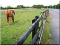

78 photos from this area
Area Information
Key information about the HU5 5SG including its size, population, and administrative classification.
- Area Type
- Postcode
- Area Size
- 9443 m²
- Population
- 1305
- Population Density
- 6727 people/km²
House Prices in HU5 5SG
19
Properties
£111,195
Average Sold Price
£30,000
Lowest Price
£160,000
Highest Price
Showing 19 properties
| Address | Type | Beds | Baths | Last Sale Price | Last Sale Date | |
|---|---|---|---|---|---|---|
| 420 Priory Road, Kingston Upon Hull, HU5 5SG | Terraced | 3 | 1 | £160,000 | Sep 2025 | |
| 440 Priory Road, Kingston Upon Hull, HU5 5SG | Terraced | 3 | 2 | £157,500 | Jan 2025 | |
| 452 Priory Road, Kingston Upon Hull, HU5 5SG | Terraced | 3 | 1 | £150,000 | Aug 2023 | |
| 448 Priory Road, Kingston Upon Hull, HU5 5SG | Terraced | 3 | 1 | £118,000 | Apr 2023 | |
| 434 Priory Road, Kingston Upon Hull, HU5 5SG | Terraced | 3 | 1 | £117,000 | Nov 2019 | |
| 422 Priory Road, Kingston Upon Hull, HU5 5SG | Terraced | 2 | 1 | £120,000 | Jun 2019 | |
| 450 Priory Road, Kingston Upon Hull, HU5 5SG | Terraced | 2 | 1 | £88,500 | Jul 2017 | |
| 444 Priory Road, Kingston Upon Hull, HU5 5SG | house | - | - | £93,000 | Oct 2005 | |
| 430 Priory Road, Kingston Upon Hull, HU5 5SG | house | - | - | £77,950 | Jul 2003 | |
| 436 Priory Road, Kingston Upon Hull, HU5 5SG | Terraced | - | - | £30,000 | Jul 1996 |
Page 1 of 2
Energy Efficiency in HU5 5SG
Amenities
Schools
| Rank | School | Type | Entry gender | Ages |
|---|
Explore more schools in this area
Go to Schools tabDemographics
Household Size
Two person
most common
Accommodation Type
Houses
most common
Tenure
61
majority
Ethnic Group
White
most common
Religion
N/A
most common
Household Composition
N/A
most common
Age
47
median
Adults (30-64 years)
most common
Household Deprivation
N/A
with no deprivation
NS-SEC
21
in Lower managerial occupations
Explore more demographic insights in this area
Go to Demographics tabPlanning
Planning Constraints
- Flood RiskPremium
- Ramsar Wetland SitesPremium
- Area of Outstanding Natural BeautyPremium
- Protected Nature ReservePremium
- Protected WoodlandPremium