Area Overview for HU5 5SA
Photos of HU5 5SA
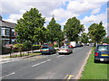
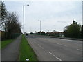
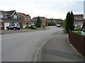
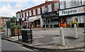
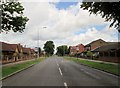
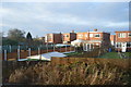
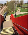
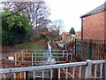
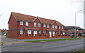
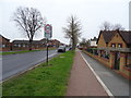
100 photos from this area
Area Information
Key information about the HU5 5SA including its size, population, and administrative classification.
- Area Type
- Postcode
- Area Size
- 8301 m²
- Population
- 1403
- Population Density
- 4904 people/km²
House Prices in HU5 5SA
22
Properties
£131,783
Average Sold Price
£55,950
Lowest Price
£189,950
Highest Price
Showing 22 properties
| Address | Type | Beds | Baths | Last Sale Price | Last Sale Date | |
|---|---|---|---|---|---|---|
| 307 Priory Road, Kingston Upon Hull, HU5 5SA | house | - | - | £142,000 | Nov 2024 | |
| 327 Priory Road, Kingston Upon Hull, HU5 5SA | Terraced | 3 | 2 | £160,000 | Dec 2023 | |
| 325 Priory Road, Kingston Upon Hull, HU5 5SA | Terraced | 3 | 1 | £155,000 | Nov 2022 | |
| 329 Priory Road, Kingston Upon Hull, HU5 5SA | house | - | - | £179,950 | Oct 2022 | |
| 323 Priory Road, Kingston Upon Hull, HU5 5SA | house | - | - | £176,000 | Sep 2022 | |
| 321 Priory Road, Kingston Upon Hull, HU5 5SA | house | - | - | £189,950 | Sep 2022 | |
| 335 Priory Road, Kingston Upon Hull, HU5 5SA | Terraced | - | - | £142,000 | Jul 2017 | |
| 315 Priory Road, Kingston Upon Hull, HU5 5SA | Terraced | - | - | £109,950 | Aug 2009 | |
| 339 Priory Road, Kingston Upon Hull, HU5 5SA | Semi-detached | 3 | 2 | £139,580 | Dec 2008 | |
| 337 Priory Road, Kingston Upon Hull, HU5 5SA | house | 3 | - | £139,580 | Dec 2008 |
Page 1 of 3
Energy Efficiency in HU5 5SA
Amenities
Schools
| Rank | School | Type | Entry gender | Ages |
|---|
Explore more schools in this area
Go to Schools tabDemographics
Household Size
Two person
most common
Accommodation Type
Houses
most common
Tenure
68
majority
Ethnic Group
White
most common
Religion
N/A
most common
Household Composition
N/A
most common
Age
47
median
Adults (30-64 years)
most common
Household Deprivation
N/A
with no deprivation
NS-SEC
22
in Lower managerial occupations
Explore more demographic insights in this area
Go to Demographics tabPlanning
Planning Constraints
- Flood RiskPremium
- Ramsar Wetland SitesPremium
- Area of Outstanding Natural BeautyPremium
- Protected Nature ReservePremium
- Protected WoodlandPremium