Area Overview for HU5 5EH
Photos of HU5 5EH
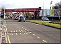
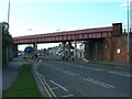
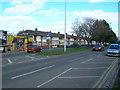
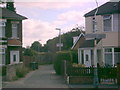


100 photos from this area
Area Information
Key information about the HU5 5EH including its size, population, and administrative classification.
- Area Type
- Postcode
- Area Size
- 1.6 hectares
- Population
- 1570
- Population Density
- 6926 people/km²
House Prices in HU5 5EH
35
Properties
£82,640
Average Sold Price
£38,495
Lowest Price
£149,950
Highest Price
Showing 35 properties
| Address | Type | Beds | Baths | Last Sale Price | Last Sale Date | |
|---|---|---|---|---|---|---|
| 5 Bermondsey Drive, Kingston Upon Hull, HU5 5EH | Flat | 3 | 1 | £62,000 | Jul 2025 | |
| 9 Bermondsey Drive, Kingston Upon Hull, HU5 5EH | Flat | - | - | £67,500 | Nov 2023 | |
| 17 Bermondsey Drive, Kingston Upon Hull, HU5 5EH | Flat | 2 | 1 | £75,000 | Oct 2022 | |
| 25 Bermondsey Drive, Kingston Upon Hull, HU5 5EH | Semi-detached | 3 | 1 | £149,950 | Feb 2022 | |
| 11 Bermondsey Drive, Kingston Upon Hull, HU5 5EH | Flat | 2 | 1 | £62,000 | Jul 2021 | |
| 10 Bermondsey Drive, Kingston Upon Hull, HU5 5EH | Flat | - | - | £64,000 | Aug 2019 | |
| 29 Bermondsey Drive, Kingston Upon Hull, HU5 5EH | Semi-detached | 3 | 1 | £135,000 | Jul 2019 | |
| 26 Bermondsey Drive, Kingston Upon Hull, HU5 5EH | Terraced | - | - | £94,000 | Apr 2019 | |
| 40 Bermondsey Drive, Kingston Upon Hull, HU5 5EH | house | - | - | £135,000 | Jun 2018 | |
| 19 Bermondsey Drive, Kingston Upon Hull, HU5 5EH | Semi-detached | 3 | - | £115,000 | Aug 2016 |
Page 1 of 4
Energy Efficiency in HU5 5EH
Amenities
Schools
| Rank | School | Type | Entry gender | Ages |
|---|
Explore more schools in this area
Go to Schools tabDemographics
Household Size
Two person
most common
Accommodation Type
Houses
most common
Tenure
72
majority
Ethnic Group
White
most common
Religion
N/A
most common
Household Composition
N/A
most common
Age
47
median
Adults (30-64 years)
most common
Household Deprivation
N/A
with no deprivation
NS-SEC
23
in Lower managerial occupations
Explore more demographic insights in this area
Go to Demographics tabPlanning
Planning Constraints
- Flood RiskPremium
- Ramsar Wetland SitesPremium
- Area of Outstanding Natural BeautyPremium
- Protected Nature ReservePremium
- Protected WoodlandPremium