Area Overview for HU5 5AP
Photos of HU5 5AP

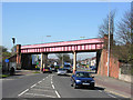
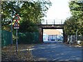

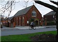
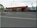
100 photos from this area
Area Information
Key information about the HU5 5AP including its size, population, and administrative classification.
- Area Type
- Postcode
- Area Size
- 1.6 hectares
- Population
- 1502
- Population Density
- 5956 people/km²
House Prices in HU5 5AP
45
Properties
£97,763
Average Sold Price
£25,000
Lowest Price
£178,000
Highest Price
Showing 45 properties
| Address | Type | Beds | Baths | Last Sale Price | Last Sale Date | |
|---|---|---|---|---|---|---|
| 17 Patterdale Road, Kingston Upon Hull, HU5 5AP | Terraced | 3 | 1 | £165,000 | Jul 2024 | |
| 59 Patterdale Road, Kingston Upon Hull, HU5 5AP | Terraced | 3 | 1 | £140,000 | Oct 2023 | |
| 21 Patterdale Road, Kingston Upon Hull, HU5 5AP | Terraced | 3 | 1 | £150,000 | Nov 2022 | |
| 11 Patterdale Road, Kingston Upon Hull, HU5 5AP | Retail | 3 | 1 | £178,000 | Jun 2022 | |
| 55 Patterdale Road, Kingston Upon Hull, HU5 5AP | Terraced | 2 | 1 | £162,000 | Mar 2022 | |
| 31 Patterdale Road, Kingston Upon Hull, HU5 5AP | house | - | - | £115,000 | Oct 2020 | |
| 15 Patterdale Road, Kingston Upon Hull, HU5 5AP | Detached | 3 | 1 | £137,500 | Jun 2019 | |
| 77 Patterdale Road, Kingston Upon Hull, HU5 5AP | Terraced | 3 | 2 | £160,000 | Apr 2019 | |
| 81 Patterdale Road, Kingston Upon Hull, HU5 5AP | Terraced | 2 | - | £90,000 | Mar 2019 | |
| 3 Patterdale Road, Kingston Upon Hull, HU5 5AP | house | - | - | £131,000 | Jul 2018 |
Page 1 of 5
Energy Efficiency in HU5 5AP
Amenities
Schools
| Rank | School | Type | Entry gender | Ages |
|---|
Explore more schools in this area
Go to Schools tabDemographics
Household Size
Family (3-5 people)
most common
Accommodation Type
Houses
most common
Tenure
57
majority
Ethnic Group
White
most common
Religion
N/A
most common
Household Composition
N/A
most common
Age
47
median
Adults (30-64 years)
most common
Household Deprivation
N/A
with no deprivation
NS-SEC
21
in Lower managerial occupations
Explore more demographic insights in this area
Go to Demographics tabPlanning
Planning Constraints
- Flood RiskPremium
- Ramsar Wetland SitesPremium
- Area of Outstanding Natural BeautyPremium
- Protected Nature ReservePremium
- Protected WoodlandPremium