Area Overview for HU5 4YQ
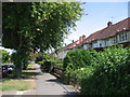
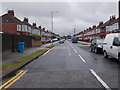
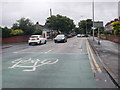
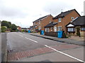
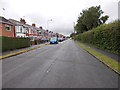
Photos of HU5 4YQ


Area Information
Living in HU5 4YQ offers a quiet, residential experience in a small cluster of homes with a population of 1,470. This area is defined by its compact size and proximity to essential services, making it ideal for those seeking a balanced lifestyle. The community is predominantly composed of adults aged 30–64, with a median age of 47, suggesting a stable demographic of homeowners and families. The area’s housing stock is largely made up of houses, reflecting a traditional, settled character. Nearby, you’ll find Kelvin Hall School and Wyke Sixth Form College, ensuring educational options for children and young adults. With rail stations like Hull and Cottingham within reach, and a ferry terminal for river access, the area blends practical connectivity with a low-key, community-focused environment. Broadband quality is excellent, and crime rates are below average, reinforcing a sense of safety. For buyers, HU5 4YQ represents a niche market with limited but well-maintained properties, suited to those prioritising security and convenience over urban vibrancy.
- Area Type
- Postcode
- Area Size
- Not available
- Population
- 1470
- Population Density
- 4813 people/km²
The property market in HU5 4YQ is dominated by owner-occupied homes, with 79% of properties owned by residents rather than rented. This high home ownership rate indicates a long-term, settled community with limited rental activity. The area’s housing stock is primarily composed of houses, which are more common than flats or apartments. This suggests a traditional, suburban character, with properties likely to be larger and more spacious than in high-density areas. Given the small population and limited land area, the housing stock is constrained, making HU5 4YQ a niche market for buyers seeking a quiet, low-maintenance environment. The focus on houses may appeal to families or professionals looking for private living spaces. However, the limited size of the area means that property choices are restricted, and buyers should consider the proximity to nearby towns for additional options.
House Prices in HU5 4YQ
No properties found in this postcode.
Energy Efficiency in HU5 4YQ
The lifestyle in HU5 4YQ is shaped by its proximity to essential amenities. Within practical reach are five retail outlets, including major names like Tesco Hull and Morrisons Daily, ensuring everyday shopping needs are met. The area’s rail network, with stations such as Hessle Rail Stn, provides easy access to nearby towns and cities, while the Hull Ferry Terminal offers alternative transport options for those using the river. Though the data does not mention parks or leisure facilities, the presence of multiple retail and transport hubs suggests a functional, community-oriented environment. The limited local amenities mean residents may need to venture slightly further for dining or entertainment, but the area’s small size fosters a sense of familiarity and ease. For those prioritising convenience and practicality, HU5 4YQ offers a straightforward lifestyle with minimal hassle.
Amenities
Schools
Residents of HU5 4YQ have access to Kelvin Hall School, a primary school, and Wyke Sixth Form College, which specialises in post-16 education. Additionally, Kelvin Hall School operates as an academy with a good Ofsted rating, indicating a strong educational offering for younger students. The combination of primary and sixth-form institutions provides a seamless educational pathway for families, reducing the need to travel for schooling. The presence of both a primary school and a sixth-form college suggests that the area caters to a range of age groups, from early childhood education to advanced studies. This diversity in school types ensures that families can meet their children’s educational needs locally, supporting a community focused on long-term residency. The good Ofsted rating for Kelvin Hall Academy adds credibility to the area’s commitment to quality education.
| Rank | School | Type | Entry gender | Ages |
|---|
Explore more schools in this area
Go to Schools tabDemographics
The community in HU5 4YQ is predominantly composed of adults aged 30–64, with a median age of 47. This suggests a mature, stable population with strong ties to the area. Home ownership is high at 79%, indicating a long-term presence of residents who are likely to have established careers and family lives. The area is characterised by houses rather than flats, reflecting a traditional housing stock that appeals to those seeking space and privacy. The predominant ethnic group is White, though no data on diversity or deprivation is provided. The population size of 1,470 means the area is small but cohesive, with a focus on local amenities and services. The age profile suggests a mix of middle-aged professionals and families, with limited data on younger or older demographics. This profile aligns with a community that values stability, with little turnover and a strong emphasis on local schools and transport links.
Household Size
Accommodation Type
Tenure
Ethnic Group
Religion
Household Composition
Age
Household Deprivation
NS-SEC
Explore more demographic insights in this area
Go to Demographics tabPlanning
Planning Constraints
- Flood RiskPremium
- Ramsar Wetland SitesPremium
- Area of Outstanding Natural BeautyPremium
- Protected Nature ReservePremium
- Protected WoodlandPremium