Area Overview for HU5 4SH
Photos of HU5 4SH
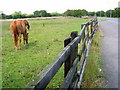
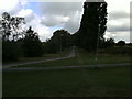
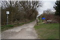
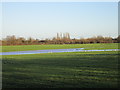
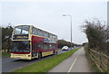
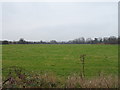
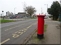
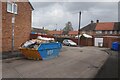
78 photos from this area
Area Information
Key information about the HU5 4SH including its size, population, and administrative classification.
- Area Type
- Postcode
- Area Size
- 3.8 hectares
- Population
- 1168
- Population Density
- 815 people/km²
House Prices in HU5 4SH
34
Properties
£109,559
Average Sold Price
£60,000
Lowest Price
£165,000
Highest Price
Showing 34 properties
| Address | Type | Beds | Baths | Last Sale Price | Last Sale Date | |
|---|---|---|---|---|---|---|
| 85 Dent Road, Cottingham, HU5 4SH | Terraced | 3 | 1 | £165,000 | Dec 2024 | |
| 81 Dent Road, Cottingham, HU5 4SH | Terraced | 3 | 1 | £105,000 | Jun 2024 | |
| 43 Dent Road, Kingston Upon Hull, HU5 4SH | house | - | - | £93,000 | Aug 2023 | |
| 59 Dent Road, Cottingham, HU5 4SH | Terraced | 3 | 1 | £149,500 | Jan 2023 | |
| 47 Dent Road, Kingston Upon Hull, HU5 4SH | house | - | - | £120,000 | Apr 2022 | |
| 33 Dent Road, Kingston Upon Hull, HU5 4SH | Terraced | 3 | 1 | £125,000 | Nov 2021 | |
| 71 Dent Road, Cottingham, HU5 4SH | Terraced | 3 | 1 | £135,000 | Sep 2021 | |
| 49 Dent Road, Kingston Upon Hull, HU5 4SH | Semi-detached | 2 | 1 | £102,500 | Dec 2019 | |
| 67 Dent Road, Cottingham, HU5 4SH | Terraced | 3 | 1 | £117,500 | Sep 2019 | |
| 25 Dent Road, Kingston Upon Hull, HU5 4SH | Terraced | 2 | 1 | £103,500 | Apr 2019 |
Page 1 of 4
Energy Efficiency in HU5 4SH
Amenities
Schools
| Rank | School | Type | Entry gender | Ages |
|---|
Explore more schools in this area
Go to Schools tabDemographics
Household Size
Two person
most common
Accommodation Type
Houses
most common
Tenure
85
majority
Ethnic Group
White
most common
Religion
N/A
most common
Household Composition
N/A
most common
Age
47
median
Adults (30-64 years)
most common
Household Deprivation
N/A
with no deprivation
NS-SEC
46
in Lower managerial occupations
Explore more demographic insights in this area
Go to Demographics tabPlanning
Planning Constraints
- Flood RiskPremium
- Ramsar Wetland SitesPremium
- Area of Outstanding Natural BeautyPremium
- Protected Nature ReservePremium
- Protected WoodlandPremium