Area Overview for HU5 4LN
Photos of HU5 4LN
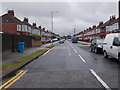
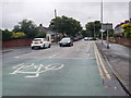
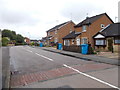
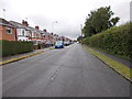

95 photos from this area
Area Information
Key information about the HU5 4LN including its size, population, and administrative classification.
- Area Type
- Postcode
- Area Size
- 7.7 hectares
- Population
- 2010
- Population Density
- 2004 people/km²
House Prices in HU5 4LN
34
Properties
£110,828
Average Sold Price
£34,950
Lowest Price
£160,000
Highest Price
Showing 34 properties
| Address | Type | Beds | Baths | Last Sale Price | Last Sale Date | |
|---|---|---|---|---|---|---|
| 45 Cropton Road, Kingston Upon Hull, HU5 4LN | Semi-detached | 3 | 1 | £160,000 | Jan 2025 | |
| 19 Cropton Road, Kingston Upon Hull, HU5 4LN | house | - | - | £156,000 | Jan 2024 | |
| 53 Cropton Road, Kingston Upon Hull, HU5 4LN | Terraced | 3 | 1 | £140,000 | Feb 2022 | |
| 25 Cropton Road, Kingston Upon Hull, HU5 4LN | house | - | - | £110,000 | May 2021 | |
| 17 Cropton Road, Kingston Upon Hull, HU5 4LN | house | - | - | £105,000 | Mar 2019 | |
| 21 Cropton Road, Kingston Upon Hull, HU5 4LN | house | - | - | £91,000 | Feb 2016 | |
| 61 Cropton Road, Kingston Upon Hull, HU5 4LN | Terraced | 3 | 1 | £104,000 | Aug 2015 | |
| 31 Cropton Road, Kingston Upon Hull, HU5 4LN | Semi-detached | - | - | £96,500 | Mar 2008 | |
| 57 Cropton Road, Kingston Upon Hull, HU5 4LN | Terraced | - | - | £34,950 | Jun 1995 | |
| 37 Cropton Road, Kingston Upon Hull, HU5 4LN | house | 3 | 1 | - | - |
Page 1 of 4
Energy Efficiency in HU5 4LN
Amenities
Schools
| Rank | School | Type | Entry gender | Ages |
|---|
Explore more schools in this area
Go to Schools tabDemographics
Household Size
One person
most common
Accommodation Type
Houses
most common
Tenure
54
majority
Ethnic Group
White
most common
Religion
N/A
most common
Household Composition
N/A
most common
Age
47
median
Adults (30-64 years)
most common
Household Deprivation
N/A
with no deprivation
NS-SEC
21
in Lower managerial occupations
Explore more demographic insights in this area
Go to Demographics tabPlanning
Planning Constraints
- Flood RiskPremium
- Ramsar Wetland SitesPremium
- Area of Outstanding Natural BeautyPremium
- Protected Nature ReservePremium
- Protected WoodlandPremium